Hike a forested ridge up to the panoramic Sherman Peak at 9909 ft.
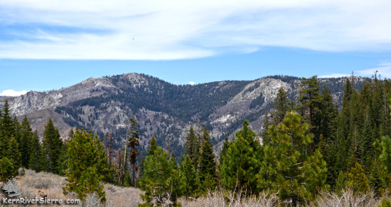
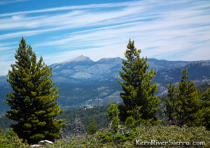
A view of Sherman Peak from the south. The trail climbs the ridgeline from the far right of the photo to the Peak (left of center.) |
THE STATS
- 5 Miles roundtrip
- Top Elevation: 9909 ft
- Lower Elevation: 9200 ft
- 900 +/- vertical feet
- Out 'n' Back Trail
- Non-Motorized Multi-Use Trail
- Sequoia National Forest
- Access: Sherman Pass Road. Kernville, Kennedy Meadows, or Johnsondale
- Note: Seasonal Closure due to snow.
- Map: Kern River Sierra Outdoor Rec Map
|
On the trail
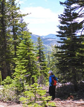 |
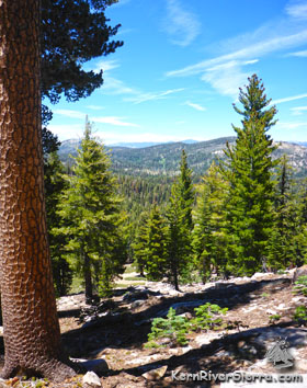
| Trail scenery. |
The hike up to Sherman Peak, at almost 10,000 vertical feet high, makes a wonderful summer hike.
Commencing at the northside of the Sherman Pass Scenic Overlook, the trail gradually climbs a forested ridge to the peak.
 |
| So much to look at! |
After an enjoyable hike up, soak in the massive views in all directions. If possible, hike on a super clear day, and don't forget the telephoto lens!
This moderate hike is sometimes combined with a trek up to Bass Peak just to the south. This is off-trail hike includes a little bit of scrambling, but also has a spectacular peak!
The Details
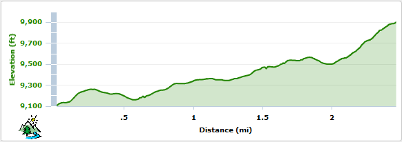
The hike ascends from the parking area at Sherman Pass, 9200 ft, opposite the Cannell Trailhead.
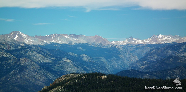 |
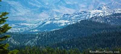
| Peering north over Golden Trout Wilderness, the Sequoia National Park and the Upper Kern River Canyon from Sherman Peak. |
Don't confuse it with another trail, Sherman Pass Trail, which drops from the parking area and connects to a huge network of trails.
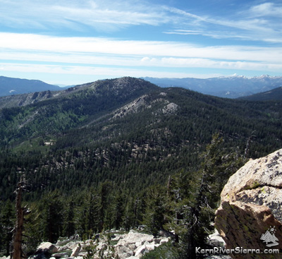 |
| The trail follows the ridge in the photo center up to the peak. Photo from Bass Peak. |
This 2.5 mile trail (each way) is an easy to moderate hike. There are a few steeper sections of trail. In the summer, the trail surface can be bit loose in a few places. While most of the trails are motorcycle-legal in this area, Sherman Peak Trail is not. The lighter use and lack of OHV trail maintenance funding, sometimes makes it less obvious to see than extremely high-use trails like Cannell Trail. With one of the very best views in the Southern Sierra, bikers will occasionally use the trail as well.
The majority of the trail is on good but-sometimes-steep and rocky singletrack. After about 2 miles, the trail merges onto Sherman Peak 4x4 Road. At that point, turn left and climb to the peak. Expect to possibly see jeeps or motorcycles at the top, especially on summer weekends.
A radio tower is at the top, along with several webcams pointed at the amazing and far-reaching views. A register is in the boulders at the highest point.
 |
| Trail scenery. |
On a clear day, the panoramic vista is immense. Since the peak is quite broad, you'll want to walk around to see everything.
Enjoy the view of the striking Kern River Canyon slicing through the heart of the High Sierra from Mt Whitney, mega granite features in Domelands Wilderness, Olancha Peak on the Eastern Sierra, Dome Rock and the Needles, the Western Divide, Kaweah Range, even an itty-bitty view of Telescope Peak in Death Valley.
With so much terrain in sight, the inspiration for plotting new adventures is impossible to resist!
 |
 |
| The headwaters of Little Kern River at Farewell Gap on the Western Divide. |
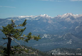
Looking into Domelands Wilderness from the Peak. |
Elevation Profile (one way)
Trailhead
Sherman Pass / Cannell Trailhead. From Kernville, the trailhead is 1+ hour away. Drive up Mtn 99, then turn right before the Johnsondale Bridge onto Sherman Pass Drive and go up to the parking area at the top.
 |
| Looking into Domelands Wilderness from the Peak. |
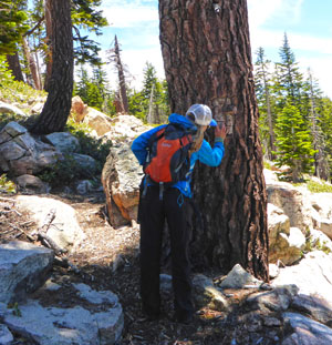 |
| Inspecting the old Blazes marking the trail. |
Other Nearby Activities
- Ski it in the winter! or bike it.
- Hike nearby & Bass Peak
- Rock Climb Spirit Rock, Ghost Rock, Kenu Wall, Trout Creek Crags
- Hike Sirretta Peak, Durrwood Creek Canyon & Beyond,
Lookout Mountain & Schaeffer Mountain, or Loop Lookout Mtn, Schaeffer Ridge, Stony Mdw, Smith Mountain, Granite Knob, Cannell Peak, Domelands...
- Raft or Kayak The Kern
- Bike Sherman Pass Trail, Cannell Trail, High Meadows Loop, Cedar Canyon Trails
- Hike Manter Meadow in Domelands
- Hike Taylor Dome & Rockhouse Peak
- Hike to Church Dome or Rock Climb it
- Hike the River Trail
- Hike Slate Mountain from Summit Trail
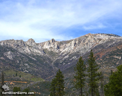 |
| Sherman Peak Cirque, as viewed from the southwest at Cherry Hill Road. |
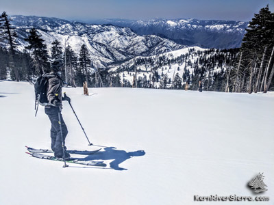 |
| Skiing down from the peak. |
|
