A supurb off-trail peak hike opposite Sherman Peak at 9909 ft.
On Bass Peak.
|
THE STATS
- Miles (roundtrip): 2.2
- Tread: Off Trail , class 1-2+
- Top Elevation: 9945 ft
- Low Elevation: 9200 ft
- Vertical: 750 ft
- Land: Sequoia National Forest
- Where: Kern Plateau, Sherman Pass
- Trailhead Access: Sherman Pass Overlook
- Near: Kernville, Kennedy Meadows
- Options: Near several other trails & peaks. For a big adventure, do the Sirretta High Route Traverse.
- Note: Seasonal Closure due to snow.
- Map: Kern River Sierra Outdoor Recreation Map, 6th ed.
|
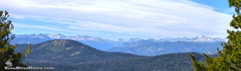 |
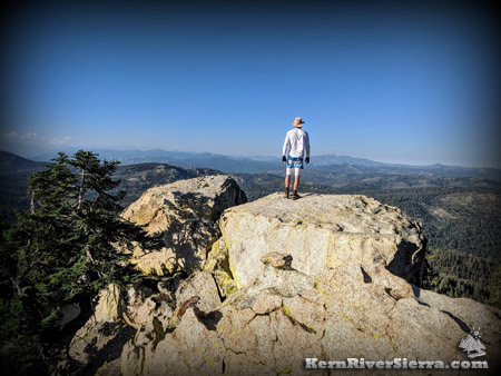
| The High Sierra on display. From the Kaweahs to Junction Peak to Mt Tyndall, Whitney, Langley...and the awesome Kern River Trench. |
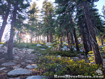
On the trail
Short but sweet; this fantastic jaunt through an old growth pine and fir forest to a dramatic peak adds a bit of adventure to the summer hiking season. Easily combined with Sherman Peak or the many other adventures in the area, this hike provides some of the greatest views with the least amount of commitment.
The Details
From the Sherman Pass Overlook, start hiking up through the hill to the southeast. The ridgeline of Bass Peak will soon become more obvious.
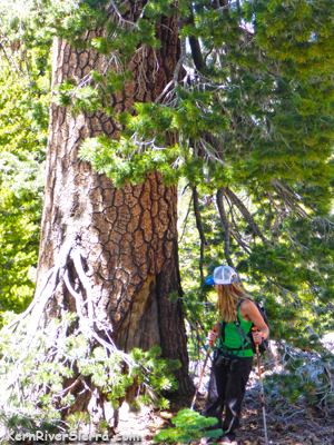
Above: Enjoying the older growth trees
on the way up. Right: The bouldery ridge. |
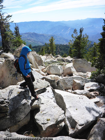 |
The easiest route is to follow the ridge to the southeast until reaching the bigger boulders. At this point, one can avoid some extra scrambling by staying partially in the trees on the west side of the ridge.
 |
 |
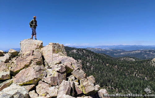
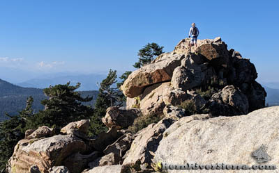
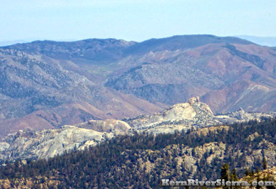
| Just about to summit. Approaching from the south is easiest. |
Looking south. The peak is in the distance. |
The peak is further to the south than it appears, and approaching it from farther south is a bit less technical. Since the actual peak isn't necessarily obvious from below, it may take some scrambling around to find the high point.
 |
 |
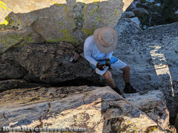
| Signing the register. |
The forest. |
At almost 10,000 feet, the register is located on the south side, just down below the peak (9945 ft).
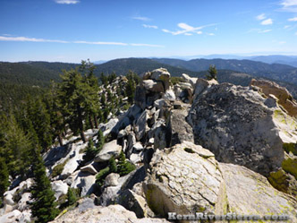
 Looking into Domelands Wilderness. Looking into Domelands Wilderness.
|
|
Enjoy the awesome mountain vistas, especially to the north! One can see the Little Kern Drainage, the Upper Kern Trench, The Kaweah range, the huge divide peaks separating the Kings River and the Kern River, and several 14,000 peaks including Mt Whitney.
Also look for some of the closer monuments; Kern Peak, Olancha Peak, the South Fork of the Kern River drainage, Blackrock Mountain, Lookout Mountain, Sherman Peak ridgeline, Woodpecker Peak, Bald Mountain Lookout, Crag Peak, Smith Mountain, Granite Knob, Sirretta Ridge Peaks, Cannell Peak, Slate Mountain above Dome Rock, Baker Point Lookout, and Sunday Peak - to name just a few.
Other Hiking Options
Sirretta Traverse:
For a very demanding hike, link a high route between Sirretta Peak with Bass Peak, and a loop with Cannell Trail. Hiking northward yields the best views and favorable sun angles. (More info here.)
Bag 2 Peaks:
Hike Sherman Peak also!
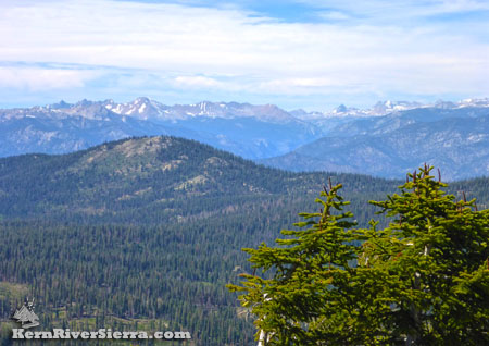
The northern view into the endless adventure land of the High Sierra. |
|
Trailhead
The Trailhead is at the Sherman Pass Overlook / Cannell Trailhead.
From Kernville, the trailhead is 1+ hour away. Drive up Mtn 99, then turn right before the Johnsondale Bridge onto Sherman Pass Drive and go up to the parking area at the top. The hike starts up the hillside to the south.
From Kennedy Meadows, take Sherman Pass Road to Sherman Pass Overlook.
From Parker Pass Dr/M50, drive past Johnsondale and cross the Kern River. Sherman Pass Drive is just past the Johnsondale Bridge on the left.
Other Nearby Activities
- Hike Sherman Peak, Bike it, Ski it
- Bike Cannell Trail, Sherman Pass Tr, High Meadows Loop, Cedar Canyon Trails
- Hike Upper Salmon Creek Falls Trail, Cannell Peak, Sirretta Peak
- Durrwood Creek Canyon & Beyond, Lookout Mountain & Schaeffer Mountain, or Loop Lookout Mtn, Schaeffer Ridge, Stony Mdw,
- Hike Smith Mountain, Granite Knob
- Rock Climb Spirit Rock, Ghost Rock, Kenu Wall, and the Sherman Pass Crags
- Manter Meadow in Domelands
- Hike Taylor Dome
- Rockhouse Peak
- Hike to Church Dome
- Raft or Kayak The Kern
- Dirt Bike 100's of miles of singletrack on the Kern Plateau
|