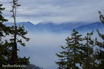
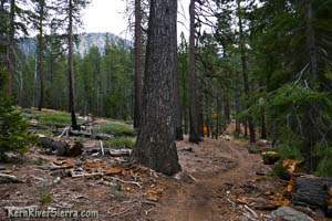
The objective is to stay on this ridge until reaching a saddle at the Old Sheep Driveway Trail, 1100 vertical feet below. Further down the firebreak trail intermingles with several rock outcroppings. The route arcs from the north to northwest by the time it reaches the saddle. (This is just over 1 mile from the northernmost Schaeffer Mountain viewpoint.) Old Sheep Driveway SaddleAfter a little more than a mile and over 1100 feet of drop, the saddle and intersection with the Old Sheep Driveway Trail is reached. The trail, heading left, has not been maintained for years and is very hard to see except for the old divot present in the ground. This descends to Stony Meadow, where it merges with the Schaeffer Trail. Look for the old trail blazes in the trees all along this trail. It gets very confusing especially towards the bottom as you near Stony Meadow because so many logs are down and bushes have grown up. New Sheep Trail Alternative
Since the route finding may be tricky, there is another option however. During the 2017 Schaeffer Fire, fire crews built a firebreak variation of the Sheep Trail just to the north. As of 2017, this is the recommended route. From the low point, one can continue along the main firebreak up the ridge .2 miles from the saddle and ascend to a small hilltop. Here, another firebreak singletrack veers left and descends to Cedar Canyon Trail near its intersection with the Schaeffer Trail. Go left at this intersection towards some boulders and descend the trail, which roughly parallels the Old Sheep Trail. [Note: Continuing north along the ridge from this intersection leads into the burn and on to some knolls with more amazing views. There seems to be firebreak trails on all the ridges, possibly leading all the way to the Kern River. The remainder of long lost Old Sheep Driveway Trail continued northeast all the way down to the Rattlesnake drainage and beyond to the Kern River as well.]
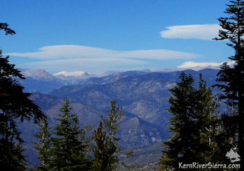
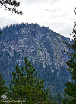
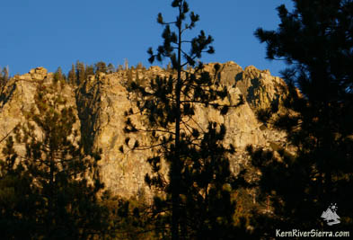
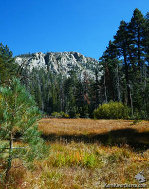
As you descend, look back up to the left to see the rugged cliffed-out side of Schaeffer Mountain. The trail also comes very close to the Old Sheep Trail on the other side of a gully. One can look across and see the old trailbed. The only bummer, is that the firebreak trail bypasses the picturesque Stony Meadow, unlike the Old Sheep Trail.
After a 1/2 mile and 500 feet of descent on this firebreak trail, there is a quick climb as it nears its intersection with Cedar Canyon Trail. At Cedar Canyon Trail, turn left. (This is about .7 miles from the Old Sheep Saddle described above) Schaeffer Meadow TrailAt the intersection of Schaeffer Meadow Trail and Cedar Canyon Trail, continue straight ahead, veering right. Stay on this trail for several miles, passing Schaeffer Meadow, Corral Meadow, and finally West Meadow.
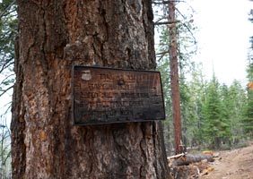
[NOTE: Heading left at this intersection takes you back up to Stony Meadow in .2 miles] The old sign labels this the "Old Sheep Driveway Trail."]
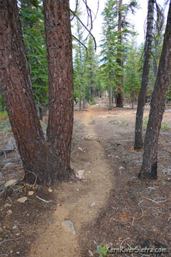
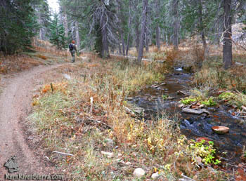
Schaeffer Meadow Trail is a well-maintained motorized multi-use trail. Passing through both healthy forest and sections of an older burn, the trail undulates up and down for awhile before climbing to Corral Meadow. In another 1/2 mile, the route passes by the "Durrwood Knoll" on the right, a destination in and of itself. Not far beyond, Durrwood Creek plummets off the edge of this plateau, through a spectacular set of cliffs and steep terrain. At 1.8 miles from the Cedar Canyon intersection, the trail briefly descends and crosses a small creek, which leads to the old Scotch Whiskey Camp on the other side of Durrwood Creek. The trail will follow the sparkly Durrwood Creek for awhile.
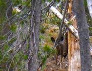
Stay left when the trail meets North Meadow Pass Trail, which climbs toward Sherman Peak. This route now turns toward Lookout Mountain and continues to climb up the Corral Meadow Fork of Durrwood Creek. Once reaching Corral Meadow, almost 4.5 miles from the Cedar Canyon intersection, veer left and hike up and over a small pass between Corral and West Meadows. Look for the resident deer, as the Schaeffer Meadow Trail reaches West Meadow. Continue along the meadow until the trail reaches an intersection of roads. A sign points the way to "Danner Meadow" straight ahead towards the left.
Make the final push up the road and back to the trailhead at the Danner Meadow Firesafe cul de sac. Nearby Trails & Hikes
DirectionsFrom the Kern River Valley, drive up M99/Sierra Way north along the Kern River. Turn right on Sherman Pass road and drive up and over Sherman Pass. 5.7 miles past Sherman Pass, turn left on Bonita Meadow Road (22S41) for about 3.8 miles, and turn right at the sign to Danner Meadow (21S46)for about a 1/2 mile. The unsigned and unofficial trailhead is at the end of the road at the Danner Meadow Firesafe area. The meadow is off to the left as you drive into the cul-de-sac and the trailhead follows the extension of the old road straight ahead. From Kennedy Meadows, drive about 23 miles up Sherman Pass Rd (9 Mile Canyon Rd) and turn left on Bonita Meadow Road (22S41) for about 3.8 miles. Then turn right at the sign to Danner Meadow (21S46) for about a 1/2 mile.
|
||||||||||||||||||||||||||||||||||||||

.jpg)
