Hike the most prominent peak in the heart of Domeland Wilderness
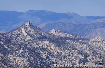 |
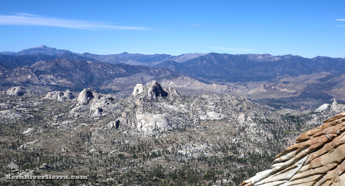
View of Rockhouse Peak in Domeland Wilderness, on the Sierra Peaks Section of the Sierra Club. Photo taken from Taylor Dome. |
|
THE STATS
- Miles: 16.5 mi-18 mi roundtrip from Big Mdw;
- 9 miles roundtrip from Manter Meadow
- Top Elevation: 8383 ft
- Lowest Elevation: 6780 ft
- Cumulative Vertical: 2200 ft from Manter Mdw
- Tread: Wilderness trails, off trail class 2-3
- Type: Out & Back, partial loop possible
- Trailhead: South Manter Trail
- Land: Domeland Wilderness, Sequoia NF
- Where: South Kern Plateau
- Access: Cherry Hill Road, Sherman Pass Rd
- Near: Kernville
- Map: Kern River Sierra Outdoor Rec Map, 6th
- Season: Spring or Fall, Summer is hot
|
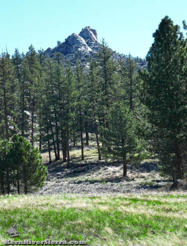 |
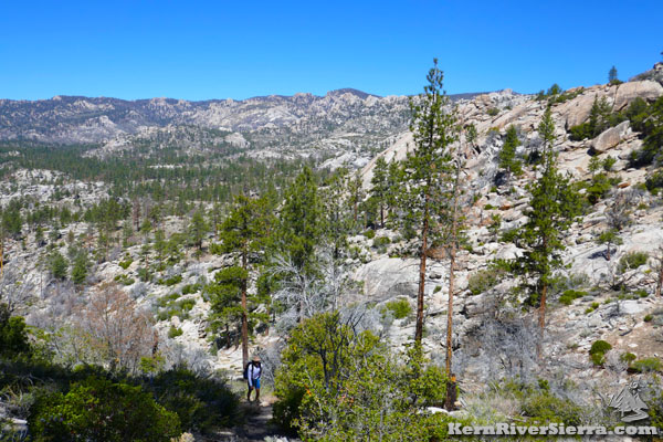
| Little Manter Meadow and Rockhouse Peak. |
Rockhouse Peak Hike
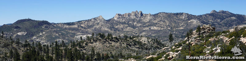
Standing high above Little Manter Meadow, Tibbets Creek Valley, and countless domes and crags, Rockhouse Peak is the highest peak in south-central Domeland Wilderness.
Rockhouse Peak is on the Sierra Club's SPS tick list for Sierra Peaks, along with nearby Taylor Dome and Sirretta Peak.
While most of the hike is on trails, the final 1+ mile to the summit is off trail and requires relatively straight-foward route finding skills.
The most common Rockhouse Peak hike starts near Big Meadow on either of the Manter Trails, although one can start from Church Dome, or the Pacific Crest Trail or Rockhouse Basin Trail in eastern Domeland Wilderness.
The hike described here begins at Manter Meadow at Manter Creek Trail, 35E12, and is a continuation of the Manter Meadow hike described here.
On the Trail
While hikers have a few potential trailheads; commencing at South Manter Trail near Big Meadow makes the shortest hike.
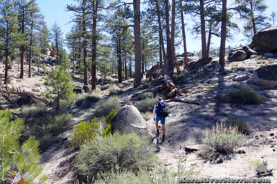 |
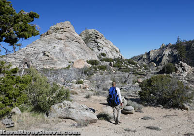
| Hiking Manter Creek Trail. After leaving Manter Creek, the trail ascends to a pass between Rockhouse Peak and the White Dome Ridge. |
Approximate Mileages:
- South Manter Trailhead to Manter Creek Trail, 35E12: 7.5 miles roundtrip
- Manter North Trailhead to Manter Creek Trail, 35E12: 9 miles roundtrip
From the east side of Manter Meadow at the intersection of Woodpecker Trail & Manter Creek Trail:
- West end of Manter Creek Trail: 0 mi
- Little Manter Meadow Camp: 1.2 mi
- Trail leaves Manter Creek near a confluence: 1.9 mi
- Trail Saddle: 3.4 mi
- Reach the granite of Rockhouse Peak: 4.5 mi
- Back to Manter Meadow: 9 mi
After reaching the east side of Manter Meadow on Woodpecker Trail, 34E08, hikers turn east on Manter Creek Trail, 35E12. The trail follows the pleasant creek as it gradually descends into Little Manter Meadow. There is at least one creek crossing.
 |
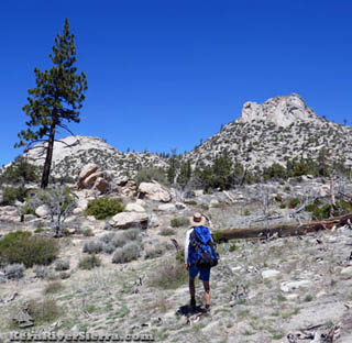
| Nearing the pass on Manter Creek Trail. |
From its intersection with Woodpecker Trail, Little Manter Meadow is about 1.4 miles east.
After another .5 miles, the trail crosses a tributary and then leaves Manter Creek. The trail will soon begin to ascend through some dry drainages on its way to the main trail saddle. A few sections of the trail are hard to follow, and a good map is highly recommended. There is one particularly brushy stretch of trail where cairns occasionally mark the way on the right hand (south) slope. Hiking along downed logs help navigate through this mess until it receives some maintenance.
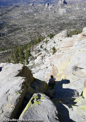
Just above the pass on the final off-trail section. This hiker is descending. On the ascent, the granite domes will be on the right and visible from the pass. |
Rockhouse
Peak is on the right. |
| |
|
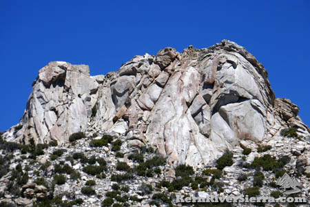 |
| The south side of Rockhouse Peak. A climbing route ascends the slab to the right of center. The Class 2-3 route is on the other (north) side. |
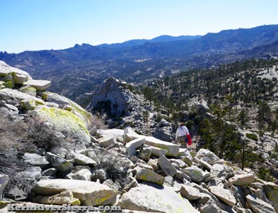
The Saddle is quite obvious, as the trail steeply drops off to meet with Rockhouse Meadow and the South Fork of the Kern River far below. At this trail pass, some small granite domes are visible to the north, while Rockhouse Peak is not yet in view. Start hiking off trail to the north, choosing the path of least resistance.
Before long, the double peaks of Rockhouse Peak appear. The obvious taller peak on the right (northeast) is the goal.
As the route approaches the steep granite walls of the south side of the peak, hikers can go either way around to reach the easier northern side. There is a class 3 route up the east side and a class 2 route up a gully on the north side of the peak. The south side contains a rock climb called "Immaculate Conception," which is rated 5.7-5.8.
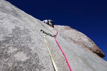 |
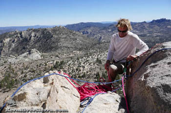 |
| Above: Climbing "Immaculate Conception," a 2-3 pitch 5.7/5.8 route on the south face of Rockhouse Peak. Right: Topping out on the summit of Rockhouse Peak. |
Make sure to leave time to enjoy the phenomenal views from the summit! A register is buried in rocks at the high point.
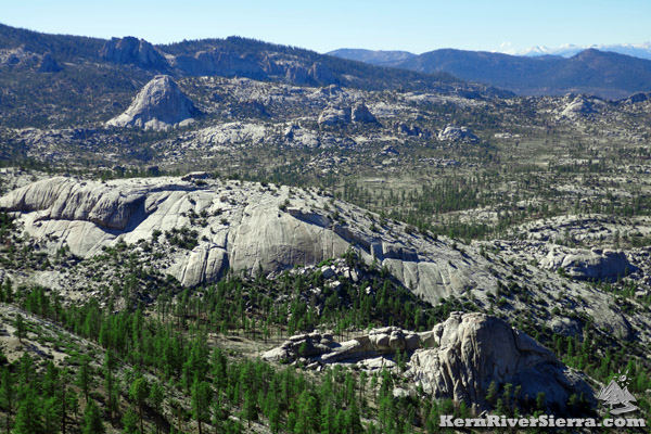
So much is in view: the many granite formations of Domeland Wilderness, Bart Dome, the North Domes, Stegosaurus Fin, Church Dome, Taylor Dome, Sirretta Peak, Cannell Peak, Bald Mountain Lookout, Pine Mountain, Olancha Peak, Mt Whitney, Mt Langley, Sawtooth Peak, Spanish Needle, Mt Owens, and so much more.
 |
| Domelands Wilderness view of Bart Dome (upper left). |
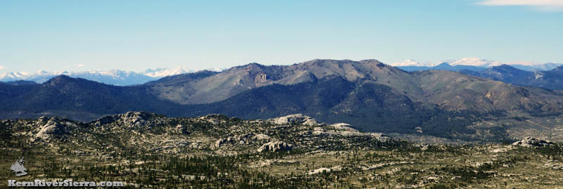 |
| Looking at Bald Mountain, from the summit of Rockhouse Peak. Notice the Great Western Divide and the Kaweah Range on the left, and Mount Whitney and Langley of the Eastern Sierra on the right. Several domes and crags are in the foreground, including the top of the impressive Columbia Dome. |
 |
| Peering down at the iconic "North Domes." These include the Stegosaurus Fin/Steamship Dome (highest point in center), Radiant Dome, Moon Dome, etc. Olancha Peak stands high to the left. |
 |
Above: Boulder hopping on a class 2 route that wrapped around from the west to the north.
Left: Hiking down the class 2-3 gully from the summit. This is on the north side of Rockhouse Peak. |
| |
|
 |
| Rockhouse Peak Summit. |
More Hiking Options
White Dome
From the trail pass, one can hike cross country south to summit White Dome, which hovers over the South Fork Canyon of the Kern River. To reach this impressive viewpoint, hikers climb a ridge with several steep granite domes before reaching White Dome in 2.1 miles.
South Fork of the Kern
Manter Creek Trail, 35E12, continues east down to Rockhouse Meadow and the South Fork of the Kern River. Large hiking loops sometimes utilize this section of trail, but brushing and maintenance is lacking. The trail is very steep as it descends 2.7 miles to the river.
Other Nearby Activities
Directions to Manter Trailheads
From Kernville, drive up Mtn 99 for 19 miles, then turn right before the Johnsondale Bridge onto Sherman Pass Drive. In 6 miles, turn right on Cherry Hill Road (22S12). After 11.5 miles, turn left on 22S07/Big Meadow Road.
After passing the North Big Meadow camping areas (Cannell Trail & Sirretta Peak trailheads) and some cabins on the left, look for the Manter North Trailhead on the left at 1.4 miles. The South Manter Trailhead is another 1.6 miles beyond.
From Kennedy Meadows, take Sherman Pass Road beyond Sherman Pass Overlook to Cherry Hill Road and (follow directions above.)
From Parker Pass Dr/M50, drive past Johnsondale and cross the Kern River. Sherman Pass Drive is just past the Johnsondale Bridge on the left. Take this to Cherry Hill Road and (follow directions above.) |