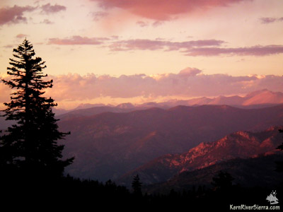
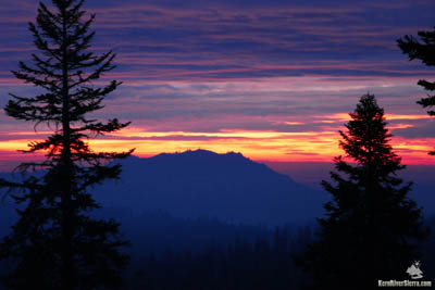
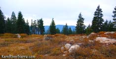
The Danner Meadow Firesafe area, a turnaround cul de sac, doubles as the trailhead parking (see directions below). Although, there is no trailhead sign, the old roadbed continues beyond, and marks the start of this hike. Before hiking, one might want to venture around to the northeast to get a sneak peek of the High Sierra.
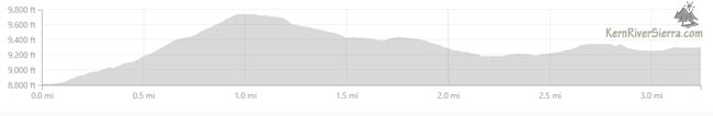
At .6 miles, the trail flattens for a brief respite before climbing steeply and merging into the boulders that comprise the summit.
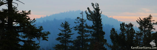
After a quick scramble, Lookout Mountain's bouldery summit is attained in 3/4 miles with almost 1,000 feet of elevation gain. As the name suggests, there are some views up there. The panoramic vista is sprinkled with pine trees, both alive and dead, but a huge amount of terrain is visible at all angles. To see even more, head on to Schaeffer Mountain!
Schaeffer Mountain
|
||||||||||||||||||||||||||||||||||||||||
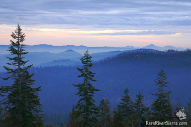 |
Looking East toward Kennedy Meadows. |
.5 miles beyond Lookout Peak, the route passes through a meadow and the trail flattens briefly before descending more.
|
In just under 2 miles (from the trailhead) and a loss of 600 feet in elevation, the route reaches the saddle between Lookout and Schaeffer Mountains.
 |
The Needles. |
Almost immediately the trail becomes much rockier. Not far ahead the peak-like pile of jumbled rocks is a false summit. The firebreak trail continues on the other side, and leads to another large heap of boulders. The top of this false summit looks back at Lookout Mountain. The narrowing ridge continues.
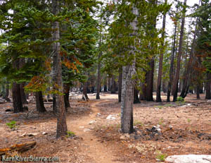
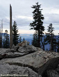
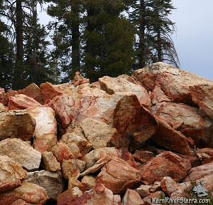
Not far beyond, 2.5+ miles into the hike, a small unassuming pile of rocks marks the summit. A small cairn (duck) houses the register. It's hard to believe that this is the actual Summit, when the drama increases significantly just ahead.
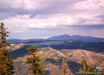
On the rocky ridge just to the west of the peak, there are some wonderful western views.
Sherman Peak is to the left while the Durrwood Creek drainage in the Cedar Canyon are just ahead with Slate Mountain, Dome Rock, The Needles, Maggie Mountain are to the right.
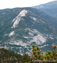
Schaeffer Mountain's West Face
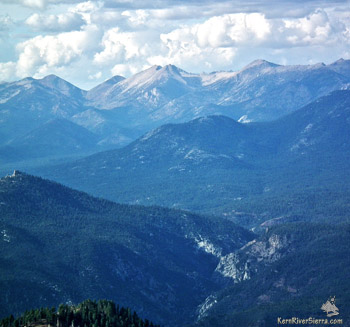 |
The Little Kern Canyon and Farewell Gap |
The hike is not over however!!
The highlight of this hike is the wanderlust-inspiring sight of the upper Kern Canyon at the precipitous western flank of Schaeffer Mountain!
Head back to the east side to catch the firebreak trail and continue on down the ridge.
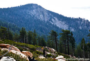
At about 3 miles from the trailhead, the route reaches another granite studded knoll with commanding views. Old maps show this as the summit of Schaeffer Mountain.
Look for some great resting/viewing spots on the large boulders at the top of the craggy cliffs, which tower above Stony Meadow far below.
Don't miss the incredible view of the deep Little Kern Canyon as it leads one's eyes up to the gunsight shape of Farewell Gap.
 |
| Schaeffer Mountain as seen from Stony Meadow to the northwest. |
|
| Summit of Schaeffer Mountain; note the small cairn (pile of rocks) that holds the register. |
Equally impressive the is the sight of Kern River Canyon flowing from the highest peaks in the Sierra, and eventually wrapping its way around the Flatiron to continue south.
When it's clear one will see through the heart of Sequoia National Park and beyond...as far as the divide between the Kings and the Kern rivers. Mount Whitney, some of the big 14ers, and the Kaweah Mountains are in view.
When you're done sucking up the wonders of the High Sierra return the way you came.
Or....
Loop Option
With the new (2017) firebreak trails, one can make a big loop hike by continuing down the ridge to the north and veering onto the Old sheep Driveway Trail to Stony Meadow. This is off the beaten path and super remote. Since it adds additional mileage and uphill hiking, prepare accordingly. Taking a map and having navigational outdoor skills is probably a very good idea.
Read the description here!
Nearby Trails & Hikes
- Lookout & Schaeffer Mountains loop with Old Sheep & Schaeffer Trails
- Durrwood Creek Canyon & beyond
- Hike Sherman Peak & Bass Peak
- High Meadows Loop (from a biking perspective)
- Cannell Trail (from a biking perspective)
- Cedar Canyon Ride (from a biking perspective)
- Sirretta Peak Hike
- Bald Mountain Lookout Tower
- Domelands - Woodpecker & Dark Canyon
- Domelands - Manter Meadow
- Domelands - Taylor Dome & Rockhouse Peak
- Domelands - Church Dome or Rock Climb it
- The River Trail
- Hike Slate Mountain from Summit Trail
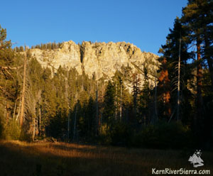
 |
Schaeffer Mountain view from the north, on Old Sheep Trail. |
Directions
From the Kern River Valley, drive up M99/Sierra Way north along the Kern River.
Turn right on Sherman Pass road and drive up and over Sherman Pass. 5.7 miles past Sherman Pass, turn left on Bonita Meadow Road (22S41) for about 3.8 miles, and turn right at the sign to Danner Meadow (21S46)for about a 1/2 mile.
The unsigned and unofficial trailhead is at the end of the road at the Danner Meadow Firesafe area. The meadow is off to the left as you drive into the cul-de-sac and the trailhead follows the extension of the old road straight ahead.
From Kennedy Meadows, drive about 23 miles up Sherman Pass Rd (9 Mile Canyon Rd) and turn left on Bonita Meadow Road (22S41) for about 3.8 miles. Then turn right at the sign to Danner Meadow (21S46) for about a 1/2 mile.
| Dont Get Lost! | |||

|
This trail and surrounding area are depicted on the 6th edition Kern River Sierra adventure map: Amazon.com |
|
Now Available: Get the Digital Version of the Map on the Avenza App! Or click here for the full Extremeline Map Store on Avenza. |