Hike to a rounded peak hovering over Big Meadow and The Domelands on the edge of the Kern Plateau. Look for tree-framed far-reaching views.
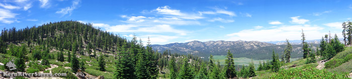
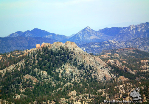
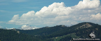
Cannell Peak on left, with Sirretta Peak, Big Meadow, Domelands on right. |
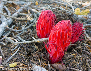 |
| Summer delights. |
|
THE STATS
- Miles: 3 mile hike
- Top Elevation: 9470 ft
- Start Elevation: 8300 ft
- Effort: 1300 feet of ascent
- Tread: Off trail hiking & route finding.
- Land: Sequoia National Forest
- Where: Kern Plateau near Big Meadow
- Closest Town: Kernville, Kennedy Meadows
- Map: Kern River Sierra Outdoor Rec Map
|
Hiking to Cannell Peak
The off-trail hiking route to Cannell Peak offers more than it seems. Despite the rounded peak and forested nature of this hike, it offers several different views that span across the entire Southern Sierra.
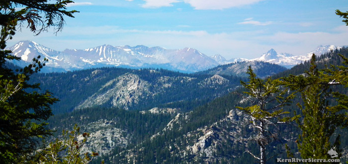 |
Once on top of Cannell Peak, an opening in the trees reveals some amazing views of the Kaweah Mountains to the north. Looking across the Kern Plateau into the heart of the Sequoia National Park high country: Mount Kaweah left, Red Spur peaks just to its right.
Any snow in the photo eventually makes its way into the Kern River. (Zoom lens used in this photo; bring binoculars to get this view!) Walk around to get additional views of the southern Western Divide Mountains and Farewell Gap.
|
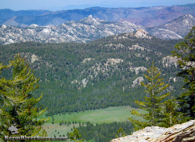 |
| Rockhouse Peak at the top of a granite-studded ridge in Domelands Wilderness. Its hardly visible but Telescope Peak in Death Valley is in the distant center of the photo. |
By hiking around the peak, one can see into the far reaches of the Kern Headwaters in the High Sierra, Mount Whitney, the peaks of Mineral King, the southern Eastern Sierra, Domelands Wilderness, Telescope Peak in Death Valley, Chimney Wilderness, and glimpses of the Piutes, Lake Isabella, and the Greenhorn range.
On the eastern side the neighboring mountains, crags, and domes display an impressive ruggedness that's enhanced with a large splash of green from the aptly named Big Meadow.
Cannell Peak is sometimes bagged in conjunction with Cannell Point, further south.
The Hike
There is no trail, but there seems to be a preferred hiking route to the top.
 |
Seen throughout the hike: Taylor Dome, with Church Dome in the left foreground. The peaks of the southern Eastern Sierra, including Sawtooth Peak, Lamont Point, Lamont Pinnacles (left to right).
|
Most of the trek is in a partially shaded forest on sometimes steep slopes.
Begin hiking at the highest point of Cherry Hill Road, to the southwest and above Big Meadow. There is a large pullout just beyond the top, where mountain bikers like to take a break while riding the Cannell Trail.
Start hiking up the ridge to the west. On the way up, it seems easiest to stay to the left of the first two rock-capped hills encountered and then hike to the right of the third high point. Traverse north to the saddle with an old dirt road, and enjoy some great views of Big Meadow and Domelands!
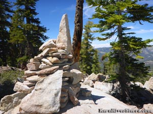 |
| Cannell Peak Summit. |
Hiking north on this road soon leads to the final slope of Cannell Peak. Pick the best looking route, and hike up the southern side of the peak. The hiker's left side seems to have the least amount of bushes.
Some of the best views are on the way up, especially of Taylor Dome and the bigger southern Eastern Sierra peaks, such as Sawtooth Mountain, Lamont Point and Peak, Spanish Needle, Owens Peak, and Jenkins Peak.
Once on top, looked for the large marker of stacked rocks marking the peak. Mount Whitney and some of the Kaweah peaks are in the distant view from this spot. The top area has an old camp site and a very old ladder still leans against a tree.
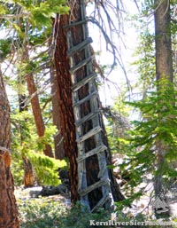 |
The great hikers from the
olden
days found ways to
improve the view. |
Since there are a lot of trees on the peak, make sure to hike around to gain the various views. The main attractions are certainly Big Meadow, Sirretta Peak ridgeline, and the Rockhouse Peak ridgeline in Domelands.
Nearby Trails & Hikes
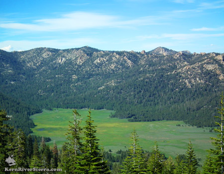 |
Big Meadow.
|
Directions
From the Kern River Valley, drive up M99/Sierra Way north along the Kern River.
Turn right on Sherman Pass road and drive 6 miles to Cherry Hill Road.
Take this almost 14 miles, and park at the high point of the road beyond Big Meadow.
The hike starts up the slope on the righthand side of the road.
 |
| Mount Whitney peeking out from the Sirretta ridgeline. |
|
