WebcamKern River Sierra Webcams

Disclaimer

Facebook Twitter Instagram

Know before you go! Current views in the backcountry.

Unfortunately, all the USFS cams are currently offline. Below are the webcams located at Alta Sierra ski resort above 6,000ft in the Greenhorn Mountains.


Exhibition
Lower Meadow
Lower Ridgeview


Additional Southern Sierra webcams are on AlertWildfire.


Plan your ultimate adventure!

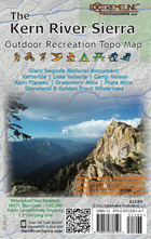
Kernville Adventure Map

Go explore! Ranging across the Piute Mountains, Kern River, BLM Lands, and Lake Isabella to the Golden Trout Wilderness, Domelands Wilderness, and the Sequoia National Monument; the Kern River Sierra Outdoor Recreation Topo Map depicts trails and mutliple sports near Lake Isabella, Kernville, Johnsondale, Black Rock Station, Kennedy Meadows, Camp Nelson, & Ponderosa areas. 6th EDITION IS OUT!

Amazon.com

Buy Locally

Map Details

Now Available: Get the Digital Version of the Map on the Avenza App!

Get this map on Avenza Maps!


For more ideas, check these out: Hike | Bike | Climb | Paddle | Wind Sports | Winter Sports |