A 5 Star Hike along the Wild & Scenic Kern River
 |
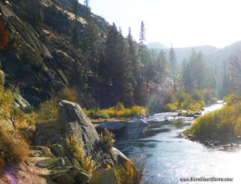
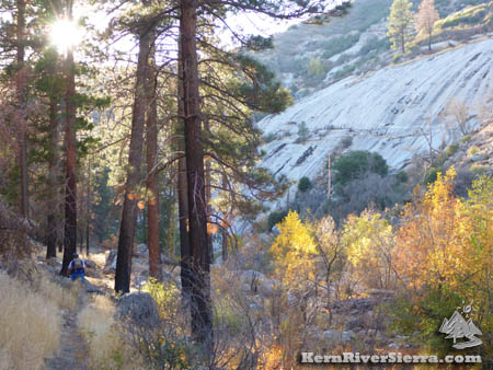
Fall colors and a placid pool on the upper stretch of the River Trail,33E30. |
|
|
THE STATS
- Miles: 5.2 mi roundtrip
- Elevation Gain/Loss: 200-1100 ft
- Hike: Up & back
- Tread: Singletrack Trail with some rocks, boulders, steep drop offs; not suitable for stock animals
- Elevation Range: 3760-4700 ft
- Scenery: grey pine, oak, cedar, manzanita and jeffrey pine interspersed forest
- Fishing: Excellent! Special regulations, see below
- Land: Sequoia National Forest
- Where: Near Johnsondale & McNalleys, 20 miles north of Kernville on Mtn 99.
- Access: Kernville, Johnsondale, Sherman Pass, Rincon Tr
- Trailhead: Johnsondale Bridge, east side of river
- Note: Do not cross or swim in the river at high flows. There are some very big and dangerous rapids on the stretch.
- Map: Kern River Sierra Outdoor Rec Map
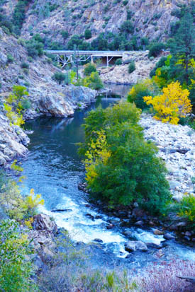
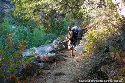
Photo: Looking back at the Johnsondale Bridge and trailhead from the River Trail. |
Hiking the River Trail
There is a reason that the River Trail, 33E30, is one of the most popular trails in the region. With phenomenal scenery year round, world class fly fishing, and big whitewater rapids intermingled with amazing swimming holes, it's hard to beat.
 |
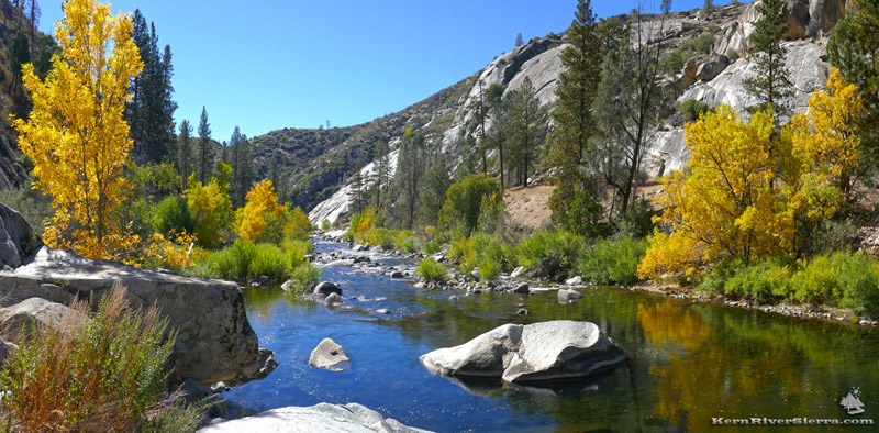
The River Trail on the Wild & Scenic Kern River, a few miles north of the trailhead. |
This 5.2 mile tree-lined trail along the Wild and Scenic North Fork Kern River is also a popular destination for short backpacking trips in the summer. Rolling and contouring along the canyons bluffs, the hiking is relatively easy except for the rough and uneven tread surface on parts of the trail. The trail is fairly well maintained for the first couple miles or so, then it gets a little roudier. After about 4 1/4 miles, the trail turns away from the Kern River and ascends a granite-lined creek canyon and meets the Rincon Trail, 33E23.
 |
The hike offers many nice forested shady spots along the way. |
Don't Miss!
The trail follows the lower 4 miles of a world class 18-mile whitewater wilderness run that is commercially rafted by local companies, known as "The Forks of the Kern." Two of the most authoritative whitewater guide books call it "one of the finest expert runs in the West," and "one of the finest stretches of expert whitewater on earth." In the spring and early summer, hikers may see kayakers masterfully paddling some huge Class 5 rapids during the peak river flows.
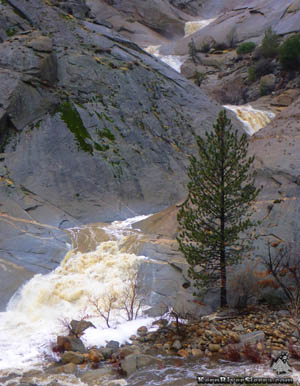
Also, don't miss where the tributary Dry Meadow Creek, which contains the phenomenal canyon known as "7 Teacups" meets the Kern River. There are actually far more teacups and waterfalls hidden above the trail, and adventuring expert kayakers will run the top 7 falls. At lower flows, this is known as one of the best swiftwater canyoneering sections in California. Hikers might have a chance to see them descend to the Kern River on late summer weekends. [Note that only the lowest slides are in view from the River Trail].
 |
 |
Dry Meadow Creek (at the bottom of The Teacups) in the Spring at a roaring flood stage. |
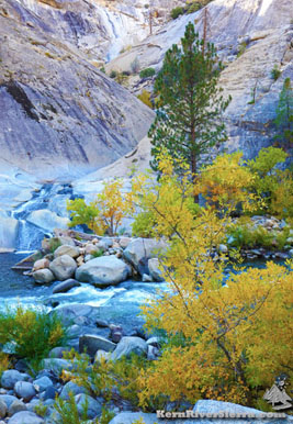
A far less powerful Dry Meadow Creek in the Fall. |
On the Trail
The hike commences at the pedestrian bridge spanning the Kern River. Stairs descend steeply down to the trail on the river. Immediately the rough rocky surface of much of the trail becomes evident as it negotiates some rugged terrain. At lower summer flows, the river is lined with numerous small pristine beaches with refreshing swimming holes and large sun soaked boulders.
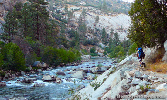 |
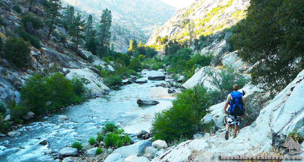
Going for a quick backpacking trip up river. |
In less than a mile, use-trails drop down to some campsites near the infamous Class 5 Carson Falls Rapid (labeled on the Kern River Sierra Map). During high flows this section of river cranks through several class 4 and 5 rapids.
A highlight for many trekkers comes up next; Dry Meadow Creek and the final terminus of the Teacups. Look for the twisting gorge of granite entering the river on the opposite side. While most of the waterfalls are out of view, there are ways to access it for the adventurous. Read more about it here!
Superb fishing and swimming pools are at the base of the final water slide on the Teacups at low river flows. Check the Kern River Flows here.
North of Dry Meadow Creek the number of hikers thin out, but there is so much more to see. The forested area near the WestWall Rapid (labeled on the Map) is quite dreamy with large trees and huge granite slabs dropping into the whitewater.
The trail continues along the river for a couple more miles before it turns away from the river and traverses the cliffs above an exposed bedrock creek. It passes by a mile shaft before reaching the Rincon Trail. This section of trail is itself a wonder.
Special Fishing Regulations
From the USFS: “From the Johnsondale Bridge upstream 5.2 miles to trail number 33E30 is a special regulation area. Fishing season on this section of river starts on the last Saturday in April and runs through the 15th of November. There is a minimum size limit of 14 inches total length and only artificial lures with barbless hooks may be used. There is a two fish limit with two fish in possession. Also between November 16th and the Friday before the last Saturday in April you may fish with artificial lures with barbless hooks and the limit is zero (only catch and release)."
 |
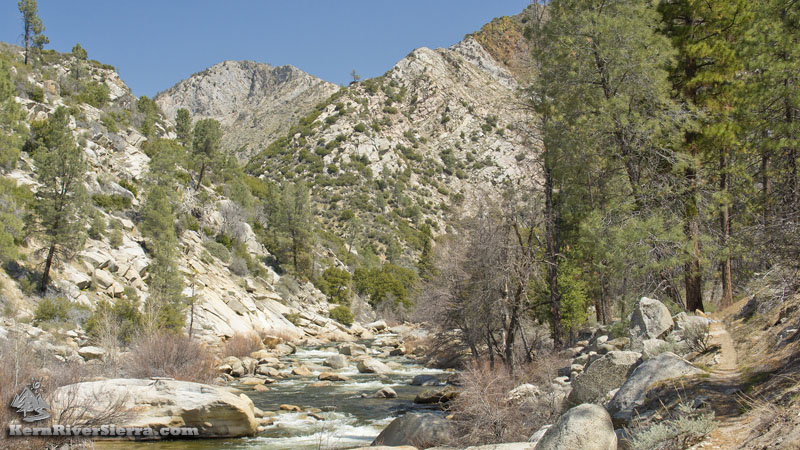
The trail just above West Wall. |
Bigger Hiking Options
Rincon to River Trail Loop.
A bigger hike entails taking the Rincon Trail (33E23) up and over a pass, and down the dramatic upper River Trail to the Kern River. This hike has become more popular recently.
The Rincon Trail is a motorized multi-use trail. Occasionally, there are motorcycles, mountain bikers, hunters on the trail.
Backpacking north on the Rincon Trail.
One can hike up the River Trail and take the Rincon Trail for several miles north. Some good options are camping are near Durrwood Creek or all the way up to the wilderness boundary near the Forks of the Kern.
 |
 |
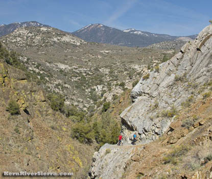
After departing the river, the is more of an old miner trail as it traverses the cliffs above an exposed bedrock creek. |
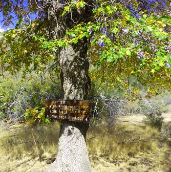
The sign on the oak tree at the top of River Trail at the Rincon Trail intersection. |
Trailhead & Directions
From the Kern River Valley, drive up M99/Sierra Way north along the Kern River. At the Johnsondale Bridge, cross the river and look for the small parking lot on the right. (If parking is full, there is some space near the Sherman Pass Road turnoff).
Take the pedestrian bridge back over the river and hike down the stairs to the trail. The trail follows the east bank of the Kern River and heads north.
From Johnsondale, drive east on M99 and park just before the Johnsondale Bridge.
 |
| Off to find his favorite fishing hole. |
Nearby Trails & Activities
|