Hike to an inspiring rock near Blackrock Station on the Kern Plateau.
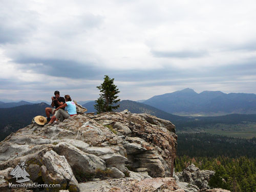
Sitting above Monache Meadows, with Olancha Peak behind.
|
THE STATS
- Miles: 1.6+ miles roundtrip
- Summit: 9060 feet
- Effort: 650 ft of elevation
- Type: Cross country/primitive trail & old logging
- Land: Sequoia Nat Forest
- Where: Northeast Kern Plateau, Blackrock Station, Kennedy Meadows area
- Map: Kern River Sierra Outdoor Rec Map
- Optional: Class 5 Rock Climbing on Granite Knob
|
The Hike
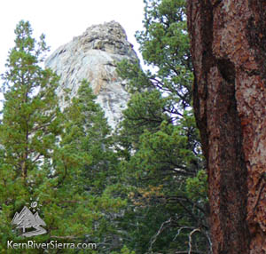
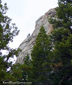
While Granite Knob looks intimidating from certain vantage points (it has many quality rock climbing routes), the northeast side is approachable.
 |
 |
The steep south side of Granite Knob. |
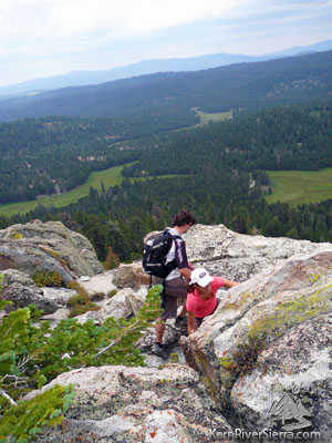
Using some route-finding skills. |
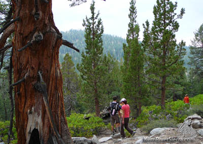
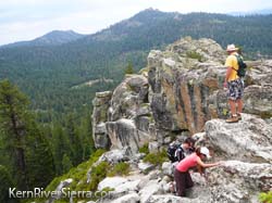
Take a cairned route cross country or follow pieces of an old logging road through a forest of fir, pine, and manzanita to reach an impressive knob of granite. Views of Monache Meadows and the surrounding peaks, meadows, and canyons of the Southern Sierra are on display from the rocky viewpoint.
From the paved road 21S36, start the hike across from (or just to the east) of the dirt road 20S39. There is no great way to describe the hike except to make your way northeast through the forest to the northeast side of the peak. The hike then passes through manzanita and some boulders before reaching the top.
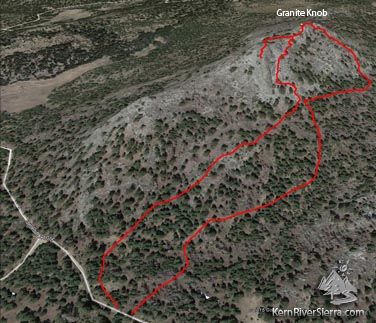 |
One version of the hike as seen from Google Earth. |
This area is also loaded with good Rock Climbing, mountain biking, and motorcycling.
Please don't throw or dislodge rocks, there may be rock climbers anywhere around this formation!!
Options
Several other hikes are nearby including:
 |
 Scrambling up. Scrambling up.
|
| Rivers of meadows below. |
|
Trailhead
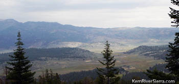 |
| Monache Meadow. |
From Kernville: Take Mtn 99 north 19 miles to Sherman Pass Road and turn right. Take this about 33 miles and turn left on Blackrock Road. Pass the Blackrock USFS Station/Information Center and continue 3.5 miles to a paved road signed "Monache Jeep Rd." Turn right. Pass the meadows, Monache Jeep Road, and the Granite-Broder Trail, and spot the west side of Granite Knob to your left. Just across from Granite Knob, a dirt road veers of left. Pass this road and park near a primitive camping area beyond. The hiking route starts to the southeast of Granite Knob, there is no official trail.
 |
| Watch for rock climbers! |
From Johnsondale: Drive east to the Kern River and turn right on Sherman Pass Road. Take this about 33 miles and turn left on Blackrock Road. Pass the Blackrock USFS Station/Information Center and continue 3.5 miles to a paved road signed "Monache Jeep Rd." Turn right. Pass the meadows, Monache Jeep Road, and the Granite-Broder Trail, and spot the west side of Granite Knob to your left. Just across from Granite Knob, a dirt road veers of left. Pass this road and park near a primitive camping area beyond. The hiking route starts to the southeast of Granite Knob, there is no official trail.
From Kennedy Meadows: Drive over the South Fork of the Kern River on Sherman Pass Road. After about 12 miles, turn right on Blackrock Road. Pass the Blackrock USFS Station/Information Center and continue 3.5 miles to a paved road signed "Monache Jeep Rd." Turn right. Pass the meadows, Monache Jeep Road, and the Granite-Broder Trail, and spot the west side of Granite Knob to your left. Just across from Granite Knob, a dirt road veers of left. Pass this road and park near a primitive camping area beyond. The hiking route starts to the southeast of Granite Knob, there is no official trail.
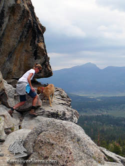
Reaching the top. |
|
|
|
|
