An alpine hike to one of the most amazing peaks in Sequoia National Monument. Hike Summit Trail from either of 2 different trailheads.
|
THE STATS
- Roundtrip Miles:
From Windy Gap TH: 10 miles
From Quaking Aspen TH: 11 miles
- Shuttle Hike:
- Top Elevation: 9302 ft.
- Windy Gap TH: 7500 ft.
Quaking Aspen TH: 7000 ft.
- Difficulty:
Windy Gap TH: 1850 ft.
Quaking Aspen TH: 2300 ft.
- Tread: Multi-use trail & class 1-2 scrambling off trail
- Land: Sequoia National Monument
- Where: Western Divide Hwy/190
- Towns: Ponderosa, Camp Nelson
- Season: Summer, Fall
- Optional: Scramble to Yokut Spire. (Class 2-5 depending on the route.)
- Map: Kern River Sierra Outdoor Rec Map, 6th ed.
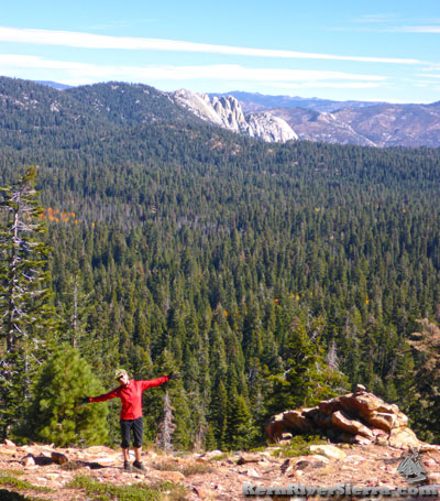
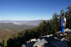
Photo: Hiker on the way up Summit Trail, with The Needles in the background. |
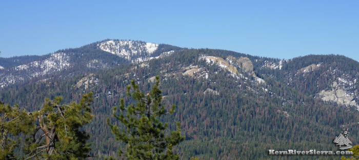 |
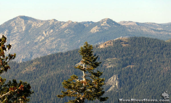
| Slate Mountain with Yokut Spire right of center. |
The Hike
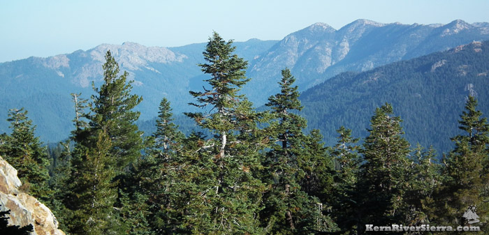
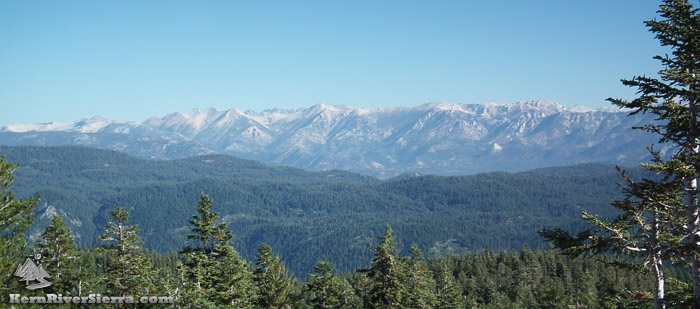
While hiking Summit Trail is a fantastic and beautiful forested hike in and of itself, attaining the summit of Slate Mountain yields one of the very best vistas in the Southern Sierra. One could spend hours looking at all that it offers: the basin of the Tule River, the dramatic peaks of the Great Western Divide, the highest sierra peaks in the Mt Whitney group, Olancha Peak, Kern Peak, The Hermit and Needles are all just some of the amazing features to look for.
 |
On the Summit Trail. |
Slate Mountain does have slate and a variety of metamorphic rock, which is unique in a land of granite. This seems to allow for a variety of wildflowers and plants that are not always present on some of the other hikes in the region.
One may hike Summit Trail from Quaking Aspen Campground, or from the Windy Gap trailhead from the south, or hike point to point with a shuttle.
 |
| View toward Maggie & Moses Mountains from Slate Mountain. |
The Hike Up to Slate Mountain
Directions to the two separate trailheads on Summit National Recreation Trail, 31E14, are described below.
Note that this is a multi-use trail and both horseriders and mountain bikers occasionally ride all sections of the Summit Trail.
The trailhead at Quaking Aspen Campground is the most popular and also offers access to Yokut Spire.
The more remote Windy Gap trailhead is also an excellent (and slightly easier) option with possible side-excursions to Freezeout Meadow and to an impressive subpeak, 8769.
These are all shown on the Kern River Sierra Map.
 |
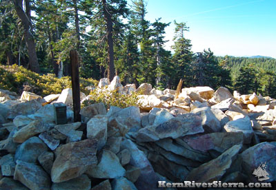 |
| On the rocky summit of Slate Mountain, looking east. |
The Slate Mountain summit & register. |
Quaking Aspen
If commencing at Quaking Aspen, find the trailhead parking just east of the campground (this is also the top of Nelson Trail). There is also access behind the campground (on the south side) between campsite #23 and #24.
 |
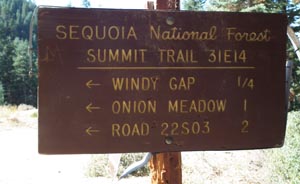
| Summit Trail sign near Bear Creek Trail turnoff. |
The trail soon starts ascending and crosses a paved access road. Stay on the main trail as some other use trails merge in from the Ponderosa area. The route passes by some meadows of golden currant and forest of pine and red fir as it ascends. After a series of switchbacks, the trail passes a wonderful viewpoint of The Needles.
Near the 8500 foot level, one can traverse the ridge to find Yokut Spire.
As the trail nears the top, it intersects with Bear Creek Trail off to the right. At this point some people climb directly up to the peak on the left. A possibly better option is to continue on the trail as it wraps around the backside almost .2 miles. Often, there is cairn marking a good spot to leave the trail below a large slope of boulders. Hiking up this avoids any brush crashing.
The rock-strewn summit contains a register and some surrounding trees for shade. Hiking back down the ridge to the north provides some of the very best views. Depending on where one started the hike, it's up to 5.5 miles to the summit.
 |
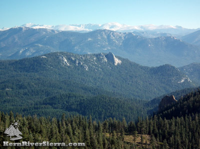
| The Great Western Divide, hovering over the Little Kern drainage. |
Windy Gap
 |
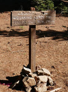
| Windy Gap Trailhead sign. |
If commencing at Windy Gap Trailhead off Crawford Road, take the trail leading north into the woods. (The trailhead is actually located a little past the saddle of Windy Gap to the east.)
The trail traverses the east side of the slope before switchbacking up to the main ridge. Here a use-trail leads out to Peak 8769. Continuing on Summit Trail, the hiking follows the ridgeline north, and passes Freezeout Meadow, which is on the right and not visible from the trail. Keep following the trail through a beautiful forest and look for a use-trail on the right leading up to the summit (see the description above). The peak is about 5 miles from the trailhead.
Other Options
Rock climbing: Some people have rock climbed the 500 foot volcanic Yokut Spire. Most do a class 3 route with great holds, but a lot of exposure. There are two known climbs according to E.C. Joe; Donut Dunk and The Prow. Both are 3 pitches and 5.8 in the old guide book.
Skiing: Slate Mountain was the site of a proposed Ski Resort, with 14 lifts in the plans. If you like to earn your turns, this is an awesome spot!
Keep Hiking: The Summit Trail continues on both ends of the hike described here, although it receives less maintenance. Another option is to drop a car at Coy Flat, and hike down Bear Creek Trail.
 |
| View of Jordan Peak Lookout & McIntyre Rock from Slate Mountain. Part of Maggie Mountain behind. |
Directions
 |
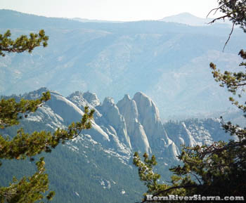
| Yokut Spire is on the lower right; the Nomad and Hermit Spire in the middle; The horizon includes Mount Whitney, Mt Muir, Mount Langley, Cirque Peak - among the tallest peaks in the continental US. |
From CAMP NELSON on the Western Divide Hwy/107, drive up toward Quaking Aspen and Ponderosa.
- For Quaking Aspen Trailhead: Drive up to Quaking Aspen Campground. There is parking just below the campground, where the Camp Nelson Trail descends. Or park off the road near the campground. (There is also access near Ponderosa near Holby Meadow (refer to map).
- For Windy Gap Trailhead: From Quaking Aspen Campground, drive over 8 miles to 21S94/Crawford Road. Turn right. Stay on the main road for about 3.7 miles and park just past "Windy Gap," the highpoint of the road. The trailhead is on the right.
From the KERN RIVER VALLEY, drive up M99/Sierra Way north along the Kern River. Cross the Kern River and continue up past Johnsondale toward Parker Pass on the M50. Turn right on Hwy 107/Western Divide Hwy.
- For Windy Gap Trailhead: Drive around 7 miles to 21S94/Crawford Road. Turn left. Stay on the main road for about 3.7 miles and park just past "Windy Gap," the highpoint of the road. The trailhead is on the right.
- For Quaking Aspen Trailhead: Drive 15+ miles to Quaking Aspen Campground.There is parking just below the campground, where the Camp Nelson Trail descends. Or park off the road near the campground. (There is also access near Ponderosa near Holby Meadow (refer to map).
From PARKER PASS DR /M50, drive towards Johnsondale. Turn left on Hwy 107/Western Divide Hwy. Continue by following the directions above for Kern River Valley.
Nearby Trails & Activities
|