A quality peak hike near Blackrock Station on the Kern Plateau.
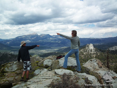
A lot to look at on Smith Mountain! Olancha Peak in the background and Jackass Peak to the right.
|
THE STATS
- Miles: 3.3
-
Effort: 1100 feet of climbing
- Summit: 9533 feet
- Tread: Multi-use trail & Class 1-3+
- Type: Up & back trail or loop
- Where: Northeast Kern Plateau
- Near: Blackrock Station, Kennedy Meadows
- Land: Sequoia National Forest
- Map: Kern River Sierra Outdoor Rec Map
- Options: Rock Climbing on the nearby crags
- Smith Mountain is on the Sierra Club's 'Sierra Peaks Section' list of peaks.
|
The Hike
In an area with several great short hikes, the trek up to Smith Mountain is certainly one of the highlights. Hike on trails and then cross country to gain the best view in the area. The actual peak requires some scrambling and climbing on steep rocks. Once there, vast panoramic views of the Southern Sierra await and make you yearn for further exploration.
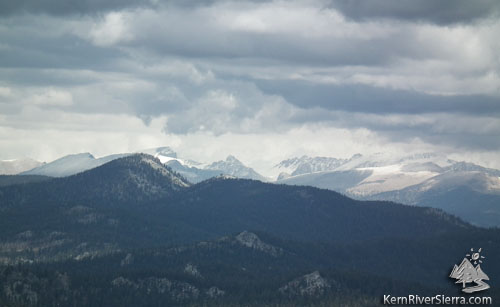 |
View North: Storm clouds gathering over Mt Whitney and the some of the other High Sierra 14ers. |
To the north Granite Knob and the Golden Trout Wilderness has a backdrop made of the highest peaks in the continental U.S., including Mt Whitney. Looking West, one can see how the Kern River canyon makes its way from the High Sierra, through the peaks of Sequoia National Park and the Kaweahs, and below the Coyote Peaks and the backside of The Needles on its way south. The obvious granite wonderland of the Domelands Wildness pops out to the South, while the South Sierra Wilderness and the South Fork of the Kern drainage are visible to the East.
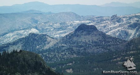 |
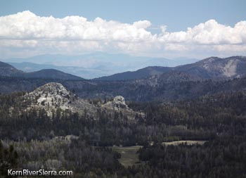
Looking south past Jackass Dome into Domelands Wilderness. |
Details
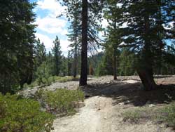 |
Albanita Trail. |
From the parking area, start hiking up the non-motorized old road signed Albanita Trail. Soon the forested trail veers left off of the old road and steadily climbs up to an intersection. Turn right here, onto the motorized Albanita Trail.
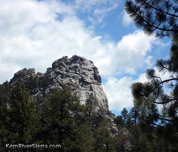
Dont miss the views of Jackass Peak behind to the left! Take the trail a little ways to a saddle on the northeast ridge of Smith Mountain. Here a sparsely cairned route leads up remnants of an old skid road, and then passes to the left of a large granite crag (good rock climbing here!), and leads to the rocky summit of Smith Mountain.
Once nearing the top, the easiest approach is from the northeast. The final scramble is a short Class 3+ climb to the top.
After enjoying the views return down the same way. The hike can be partially looped by taking the western portion of the Albanita Trail and then climbing back to the parking area on a dirt road; or finding that orginal old dirt road/trail that connects to the parking area.
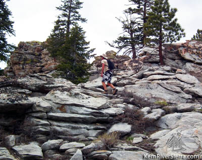 |
| Approaching the summit. |
Options
Several other hikes are nearby including:
This area is also loaded with good rock climbing, mountain biking, and motorcycling.
Trailhead
From Kernville: Take Mtn 99 north 19 miles to Sherman Pass Road and turn right. Take this about 33 miles and turn left on Blackrock Road. Pass the Blackrock USFS Station/Information Center and continue 3.5 miles to a paved road signed "Monache Jeep Rd." Turn right. Take this all the way to the end. The road will eventually turn to dirt and end at a signed trailhead.
 |
| The South Sierra Wilderness and Hooker Meadow to the east. |
From Johnsondale: Drive east to the Kern River and turn right on Sherman Pass Road. Take this about 33 miles and turn left on Blackrock Road. Pass the Blackrock USFS Station/Information Center and continue 3.5 miles to a paved road signed "Monache Jeep Rd." Turn right. Take this all the way to the end. The road will eventually turn to dirt and end at a signed trailhead.
From Kennedy Meadows: Drive over the South Fork of the Kern River on Sherman Pass Road. After about 12 miles, turn right on Blackrock Road. Pass the Blackrock USFS Station/Information Center and continue 3.5 miles to a paved road signed "Monache Jeep Rd." Turn right. Take this all the way to the end. The road will eventually turn to dirt and end at a signed trailhead.
 |
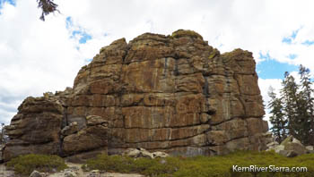 Crag near the Smith Mountain peak. Crag near the Smith Mountain peak.
|
Jackass Peak. |
|
|
