Hike through the rugged & remote terrain of Taylor Creek & Taylor Dome
 |
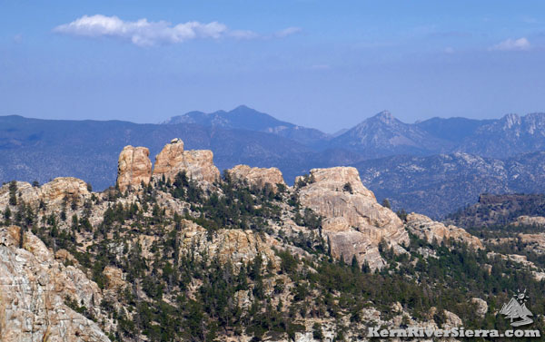
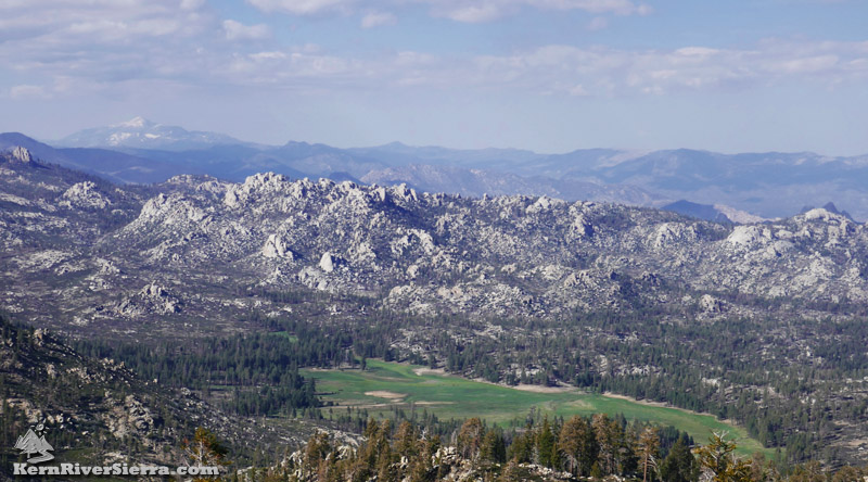
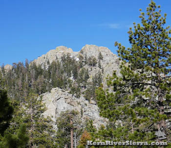
| Looking across to Taylor Dome in the center, with Church Dome just behind to the left. The flat volcanic peak of Black Mountain is to the right. The Eastern Sierra backdrop includes Sawtooth Peak, Lamont Peak, & Lamont Pinnacles (right to left). Photo taken from Cannell Peak. |
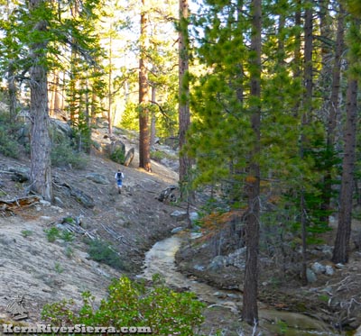 |
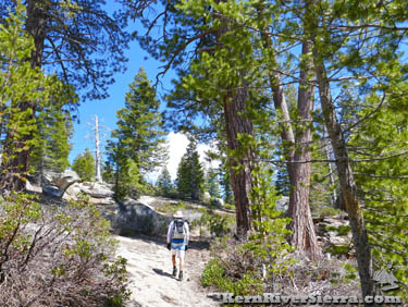
| Big Meadow Trail, along upper Taylor Creek. |
|
THE STATS
- Big Mdw Tr: 3.9 mi (1 way)
- Taylor Dome: 4.6 mi roundtrip
- Top Elevation: 8802 ft
- Vertical Effort: ft
- Tread: Trail 34E15
- To Taylor Dome: Off trail, Class 3+
- Type: Out & Back
- Land: Sequoia National Forest
- & Domeland Wilderness
- Where: Kern Plateau
- Access: Cherry Hill Rd
- Trailhead: Big Meadow Rd
- Near: Kernville, Kennedy Mdws
- Map: Kern River Sierra Outdoor Rec Map, 6th ed.
|
Hiking Big Meadow Trail, 34E15
The Big Meadow Trail/34E15 provides access to some of the wild and beautiful land in the upper Taylor Creek watershed and to an iconic granite peak, Taylor Dome. Along with nearby Sirretta Peak and Rockhouse Peak, Taylor Dome is on the Sierra Peaks Section of the Sierra Club.
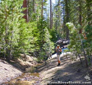 |
| Hiking on upper Big Meadow Trail. |
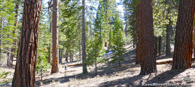
Making a great summer hike, most of the trail is forested and stays well above 7,000 feet.
Commencing just to the south of the South Manter Trail, the Big Meadow Trail/34E15 connects Big Meadow to the Taylor Meadow area in 3.9 miles.
The trail actually continues through Taylor Meadow where it connects to Woodpecker Trail, which leads to Church Dome and Manter Meadow. A large 12+ mile loop is possible here. The trails and roads are depicted on the Kern River Sierra Map.
Trailhead Elevations
- Big Meadow Trailhead Elevation: 7825 Ft
- Taylor Dome Elevation: 8802 Ft
- Taylor Meadow Elevation: 7100 Ft
 |
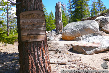
A short section of the trail is in Domeland Wilderness. |
| On the initial climb from the Big Mdw T.H. |
|
On the Trail
While Big Meadow Trail makes a fantastic hike from either trailhead, most people start at Big Meadow since its a shorter drive. This is the quickest and easiest route to Taylor Dome, and is also easily linked with a Manter Meadow hike.
The hike casually ascends for most of the way to the high point where peakbaggers can leave the trail for Taylor Dome. From this saddle, the Big Meadow Trail follows upper Taylor Creek downhill toward Taylor Meadow.
NOTE: There are several old signs marking the trails, but they are not always obvious.
 |
| Just after the trail makes a hard right turn to the south. |
 |
|
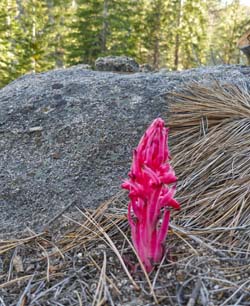
| Land of snowflowers.
|
|
Approximate Cumulative Trail Mileages
- Big Meadow Trailhead: 0.0
- 34E15A, an obscure connector trail to South Manter Trail cuts off on the left: .6 mi
- Big Mdw Tr turns right/south: .6 mi
- Saddle and Taylor Dome Turnoff: 1.3 mi
- Taylor Meadow TH at Rd 24S32: 3.9 mi
- Cattle Fencing at Taylor Meadow: 4.5 mi
- Woodpecker Trail Turnoff: 5 mi
- Rd 24S33 at Rattlesnake Meadow: 6.1 mi
(part of the old Bartolas Trail).
- Meadow section to Rd 24S13: 6.8 mi
- Rd 24S14 near Bartolos Country: 7.5 mi
Taylor Dome Excursion
From Big Meadow Trail this route involves hiking off trail for almost 2 miles roundtrip. The total hike is about 4.6 miles from the upper trailhead or roughly 7 miles from the lower trailhead.
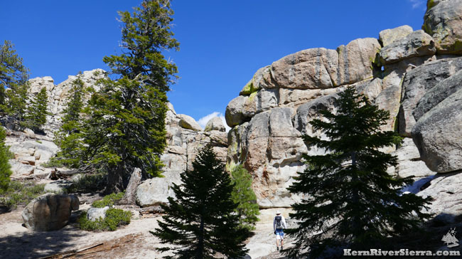 |
| The route passes by several interesting rock formations before reaching Taylor Dome at 8802 ft. |
After hiking about 1.3 miles from the Big Meadow Trailhead, the trail reaches a saddle at the top of the Taylor Creek watershed. This is where hikers depart the trail in a northeast/east direction and follow the ridge to Taylor Dome. The easiest route is to stay on the north side of the ridge while approaching Taylor Dome.
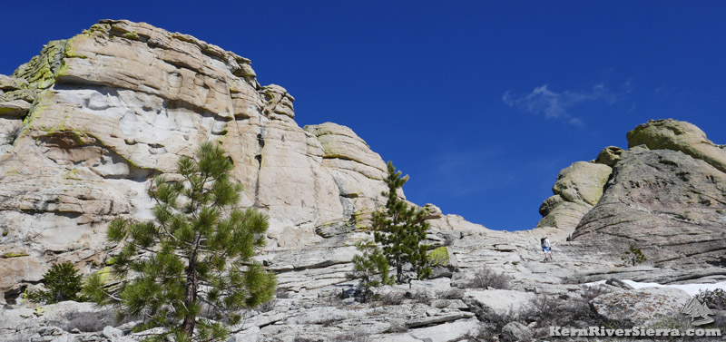 |
| The final approach to Taylor Dome, which is on the left. The hiker is heading for the low point before veering left and climbing up. |
Once at the base of Taylor Dome, aim for the saddle. Once there, the easiest way is to briefly traverse over to the left and then up a shallow chimney. There are large handholds but it has a couple exposed class 3-4 moves. See photos below:
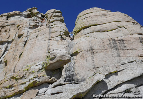 |
| On Taylor Dome; in the crux of the climb. |
 |
| Another view of the crux from the saddle. Notice the hiker standing in the pocket just above the exposed section. Just above the hiker, there is an easier chimney. |
Other hikers have described another way up on the north side. Some say it's easier, while others say it's slightly harder. The south side is the steepest with some rock climbing routes.
Once on top, enjoy the numerous views of Domeland Wilderness, the surrounding Kern Plateau, Eastern Sierra, and the Greenhorn Mountains!
 |
| Looking down at Manter Meadow and Domeland Wilderness from Taylor Dome. The Eastern Sierra and Olancha Peak are in the background. |
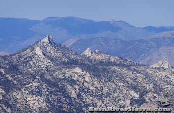
View of Rockhouse Peak in the heart of Domeland Wilderness, also on the Sierra Peaks Section of the Sierra Club. |
 |
| |
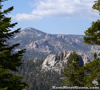
A view of the Sirretta Ridge on the way up. |
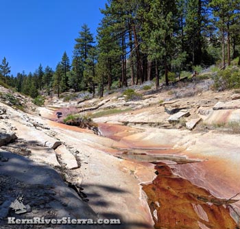 |
| In the Fall: an almost dry Taylor Creek slides down bedrock near the lower trailhead. |
 |
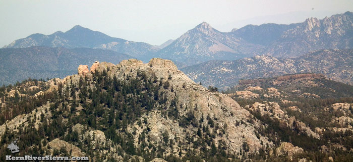
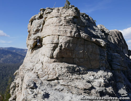
| Taylor Dome as viewed from the trail. |
Hiking Options & Excursions
Loop with Church Dome & Manter Meadow
Hikers can make a much larger loop by combining Big Meadow Trail, Woodpecker Trail past Church Dome, and South Manter Trail.
The loop is approximately 12 miles with roughly 2600 feet of vertical elevation.
A map is highly recommended for this loop hike; there are some confusing intersections complicated by numerous cow trails in the Taylor Meadow area.
Other Nearby Activities
Trailhead
From Kernville, drive up Mtn 99 for 19 miles, then turn right before the Johnsondale Bridge onto Sherman Pass Drive. In 6 miles, turn right on Cherry Hill Road (22S12). After 11.5 miles, turn left on 22S07/Big Meadow Road.
After passing the North Big Meadow camping areas (Cannell Trail & Sirretta Peak trailheads), the Big Meadow Trailhead is another 1.7 miles beyond, just past the South Manter Trailhead.
From Kennedy Meadows, take Sherman Pass Road beyond Sherman Pass Overlook to Cherry Hill Road and (follow directions above.)
From Parker Pass Dr/M50, drive past Johnsondale and cross the Kern River. Sherman Pass Drive is just past the Johnsondale Bridge on the left. Take this to Cherry Hill Road and (follow directions above.)
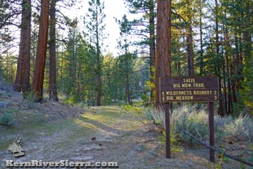
Big Meadow Upper Trailhead at Big Meadow on Rd 23S07 |
 |
| |
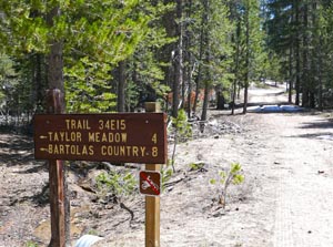
Lower trailhead near Taylor Meadow on Rd 24S32. |
|