A short hike leads to a Lookout on the Western Divide with huge views!
|
THE STATS
- Miles: 1.2 miles roundtrip
- Top Elevation: 8142
- Difficulty: 550 vertical ft
- Tread: Multi-use trail, optional scrambling along the ridge
- Land: Sequoia National Monument
- Where: off Western Divide Hwy
- Towns: Johnsondale, Ponderosa
- Season: Summer, Fall
- Noteworthy: Check the webcams
- Map: Kern River Sierra Outdoor Rec Map, 6th ed.
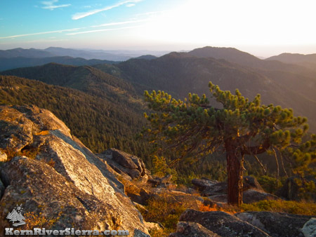
Photo: The view southwest over the Greenhorns. |
 |
|
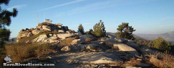
| Mule Peak Lookout Tower. |
|
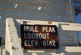 |
| Now you know where you are. |
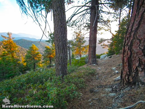
Mule Peak Lookout Trail, 31E43
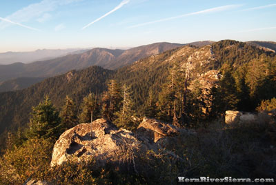
A pleasant alpine trail leads up to a rocky ridgeline housing the Mule Peak Lookout tower. As one would expect, there are superb panoramic views of the surrounding and distant mountains in all directions.
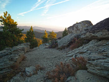
The fairly steep trail commences from the dirt lot and heads west through a conifer forest of red fir and ponderosa pine. After several switchbacks it ascends over 500 feet to the flat rocky peak and lookout tower.
As of 2019, the facility was unmanned.
 |
| Mule Peak Trail. |
Check the lookout webcams for weather conditions before going!
The Lookout
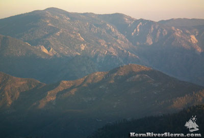
Built to detect wildfires, the tower looks straight across the Kern River Canyon at Sherman Peak and a large swatch of the Kern Plateau, ranging from Olancha peak in the north to Cannell Peak on the southern plateau.
To the south and west, the endless ridges and peaks of The Greenhorns light up, including the Tule Indian Reservation, Baker Point, Sunday Peak, Black Mountain, Tobias Peak, and Shirley Peak.
To the north, look for Moses Mountain, Maggie Mountain, Nelson Peak, Solo Peak, Slate Mountain, and the High Sierra's Great Western Divide Peaks.
If you look closely, the silhouettes of Giant Sequoias line some of the ridgetops. After all, this isn't far from the Trail of 100 Giants!
Directions
 |
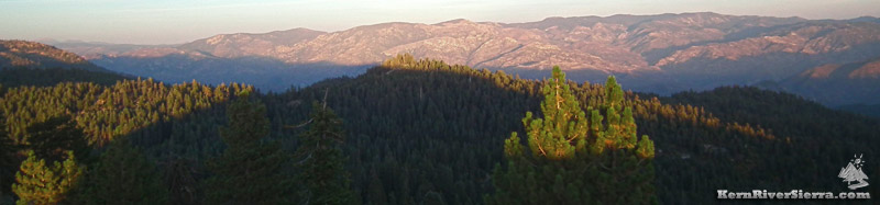
Looking across the Speas Ridge and the Kern River drainage to the top of Salmon Creek Falls (left)
with Cannell Peak, 9,470 feet (the high point). Corral Peak is lower to the right. |
The acces road for Mule Peak Lookout Trail is between the Trail of 100 Giants and Dome Rock on the Western Divide Hwy/107.
About 2.3 miles north of Trail of 100 Giants and just past Bone Creek, go northwest on road 22S03 for about 4.5 miles. After passing part of Crane Meadow, turn left on 22S03J and quickly arrive at the trailhead parking area.
Another access point is on Crawford Road 21S94 near Nobe Young Creek. After a couple miles, it intersects with road 22S03.
 |
 |
| Looking north. The mountains of the Great Western Divide are in the distance. |
Scramble around for more great viewpoints. |
Nearby Trails & Activities
|