A steep trail leads to a prominent granite spire, hikable year-round.
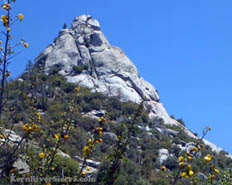
Sentinel Peak as seen from trail level. |
THE STATS
- Difficulty: 1400 vertical ft
- Tread: Up & back trail with some class 2-3 scrambling.
- Land: Sequoia National Monument
- Where: Lloyd Mdw Rd, 22S82
|
Hiking to Sentinel Peak
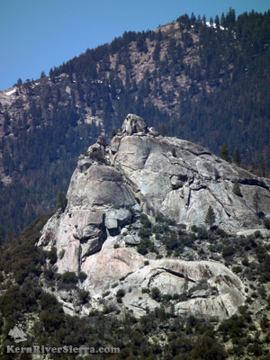 |
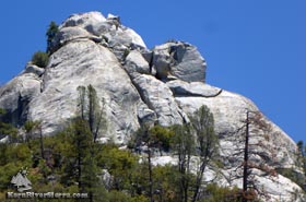
| The Sentinel from the east. |
Standing guard over a large swath of the Upper Kern River watershed, Sentinel Peak is one of the more impressive of the large granite rock features in the area.
The prominence of the peak tempts hikers with a decent trail leading to the panoramic rock viewpoint.
located near Johnsondale and Camp Whitsett, it was built by the Boy Scouts in the 60's and still sees plenty of boots during summer camp. It also seems to get occasional-but-consistent use from hikers and rock climbers seeking to get off the beaten path.
Located before the usual winter closure gate on Lloyd Meadows Road, the peak can be hiked year round.
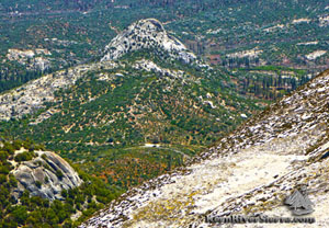
Once on top, the views include Dome Rock, The Needles, Upper Kern Canyon, Golden Trout Wilderness, Schaeffer Mountain and The Sherman Peak Massif, Durrwood Canyon & falls, upper Kern River Valley and Peaks, Speas Ridge, and the wild watersheds of Nobe Young Creek and Dry Meadow Creek.
Hiking the trail
With no signs or official trailhead parking, the start of the trail is almost invisible as it takes off in a shady bushy spot off Lloyd Meadows Rd, 22S54.
 |
Looking north from Sentinel Peak. |
The trail starts about 1/3 mile past the Camp Whitsett turnoff.
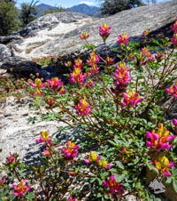 |
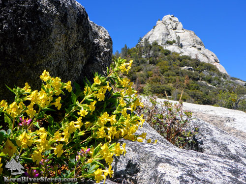
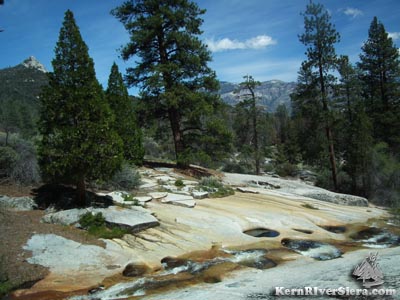
| Sierra flowers & granite. |
It helps to look for a cairn (stacked rocks) on the other side of the road, marking where the trail continues down to Camp Whitsett. Start hiking on the west side of the road.
Climbing a ridge through varying amounts of manzanita, oaks, some grey pine, chaparral, the trail can be steep and rutted in places. Early in the hike, Elephant Knob stands conspicuously to the southeast.
A section of class 2-3 scrambling is encountered midway through the hike. Cairns or some sun-bleached flagging usually mark the route as it veers to the right along the granite.
The Sentinel peeks his head out as the trail continues up the ridge and then wraps around to the west. Once the trail turns to rock, scramble up the granite slab to a large ledge, where the upper summit block stands.
 |
Looking down the granite face at
Elephant Knob and Borrowed Boot
Buttress (bottom left).
|
Class 5 climbing is required on the last 20-30 feet to gain the very top. This can be avoided by simply enjoying the views from the base and boulders below. Local hiking legend, Ruby Jenkins, called this ledge 'the crown of the Sentinel' and the top, 'the fortress'.
The northwest corner of the summit block is the shortest route to the top and considered a 5.4 by rock climbers. A bad landing below encourages the use of a rope; there are bolts on top.
The south side is rated 5.9, and is the top pitch of Cosmo the Cosmic Crow 5.10+. There are at least 5 named climbing routes on the south and southwest sides. More on Rock Climbing here.
 |
 |
 |
| Plenty of these views on the hike: Sentinel Peak from the ridge below. |
A closer look at the upper southwest side; the trail continues west and eventually climbs the north side. |
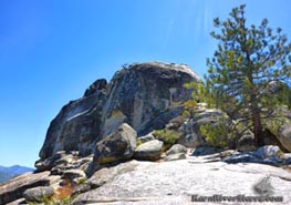
The 20-30 foot+ summit block at the top of Sentinel Peak, as seen from the northwest. The easiest route to the top is considered a short 5.4 climb. |
Nearby Trails & Hikes
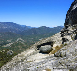 |
| Looking south toward Kernville from the ledge below the summit. |
Directions
From the Kern River Valley, drive up M99/Sierra Way north along the Kern River.
Cross the Kern River and continue up past Johnsondale on the M99/M50.
Turn right Lloyd Meadows Rd 22S82, and drive 2.8 to the unmarked trailhead. (Pass the Camp Whitsett turn off; the trail is .3 miles beyond.)
Park in one of the small turnouts along the road.
 |
| Looking across to Sentinel Peak and the Kern Plateau from nearby Nobe Young Creek. |
|
