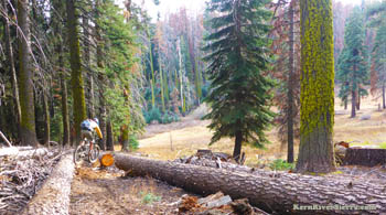
Be ready for anything on this one! Note that Portuguese Pass Trail and upper Tobias Trails are open to motorcycle use, while Pup Meadow Trail and lower Tobias trail are human powered only. The DetailsThe upper Tobias trail starts at Frog Meadow Campground, down past the USFS cabins. The exact location of the start of the trail has changed a few times in the last couple years due to a logging operation. The trail is on the left of the road, while Frog Meadow is to the right. There is now a new sign indicating the trail, but it is located about 20 feet below the sign. The Upper Tobias Trail is legal for motorcycles, although its rare to see them. The trail follows a section of Frog Creek Canyon before it merges with Tobias Creek.
The top is really fast with plenty of carvy turns, with sections of steep and rocky technical sections, while the lower section crosses the creek and has some climbing. Be aware that the trail crosses a few dirt roads.
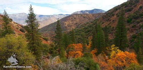
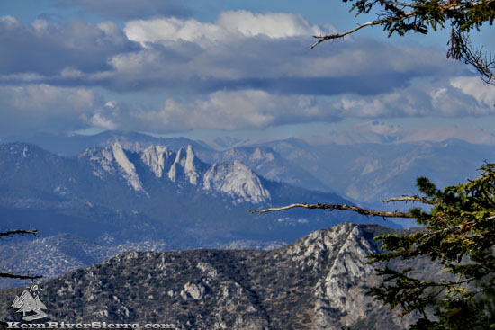
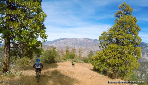
At 2.5 miles, the trail spits you out at a paved road, where you pedal left to find the rest of Tobias Trail. This entire stretch is designated non-motorized all the way to Fairview Bridge. Go left on the pavement momentarily and look for the trail on the right, which is partially blocked off with boulders. It quickly drops down to the creek; veer right along the creek and cross. The trail briefly heads left before heading out across the flats. Soon it starts to drop along the ridge above Tobias Creek. This section is fast and fun; but don't forget to peak at the Needles and the High Sierra!
As it cuts through the wilderness, most of the next few miles of trail stay fairly high above the creek. After a long series of tight steep naturally-banks turns, the trail reach the creek. Usually, there is a log to cross just to the right. On big water years or in the Spring, the crossing could be difficult. A White-Man petroglyph on the creekside boulder says H. Mars 1904. Some technical biking through the incense cedars and pines lead to a quick climb/hike-a-bike up out of the creek basin. Faster and straighter, the trail now stays above the creek. There are some hills and short steep climbs, especially in the last few miles.
Near the bottom, Tobias Trail merges onto Whiskey Flat trail. Pedal left/north to the Fairview/McNally Bridge to finish. NOTE! Bikers can avoid the final steep climb, by taking an old flume trail that is just up from the rocky Flynn Creek crossing. Look for an unrefined trail (an old flume) that contours flatly - off to the right. When it reaches Whiskey Flat Trail, turn left. The trail stays on the old flume. (This sections bypasses the Flynn Canyon Trail turnoff.) OR, if you are crazy fit, go right to add a grueling 14 miles of Whiskey Flat Trail back to Kernville. Ride VariationsRIDE FROM PUP MEADOW TRAIL As of Fall 2018, the recommended route is to take Pup Meadow Trail (newly cleared and re-opened) to Frog Meadow/Tobias Trail from the Johnsondale side.
Since most bikers leave a shuttle at McNally's/Upper Whiskey Flat Trailhead and are already north, it makes sense to continue up past Johnsondale to Road 23S16. Click here to read about several ways to access the 4 mile Pup Meadow Trail.
RIDE FROM GREENHORN SUMMIT This is a popular option, but much of the area was affected by the Cedar Fire. To ride from Greenhorn Summit, take Portuguese Pass Road (easier) or Trail (demanding) to Portuguese Pass. At the Pass, hop onto the North Portuguese Pass Trail for a few miles, then drop down to the dirt road 24S50. Take this easy cruiser all the way to Frog Meadow Campground where the Tobias Trail starts. For most riders, the ride ends at McNally's (which is about 15 miles north of Kernville).
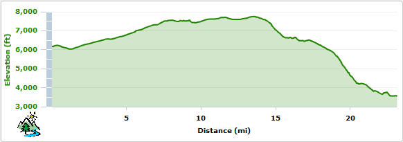
If your legs are made of steel, you can continue on Whiskey Flat Trail to Kernville or take the Old Flume Trail back. Each are very demanding rides by themselves. Loop OptionsStarting at the Greenhorn Summit Sand Shed, some bikers prefer to ride the roads out to Frog Meadow then descend Upper Tobias and ride the road back up to Portuguese Pass. At this point, they ride Portuguese Pass Trail back. Similar loops are now possible with the Pup Meadow Trail from the North. To loop the entire trail, ride through Johnsondale to the spectacularly scenic USFS road 22S10, and climb this to take Pup Meadow to Tobias Trail. Return up pavement to Johnsondale. This is big! Winter RidesWinter Riding on Lower Tobias, Whiskey Flat, and Flynn Canyon Trails. From McNally's, ride across the bridge to Whiskey Flat Trail and on to Tobias Trail. Its steep in places, but possible to ride all the way up to the creek crossing. On the way back down, one can take the lower section of Flynn Canyon Trail (out 'n' back) and/or take the bypass trail on the old flume (described above) to make a small loop back to Whiskey Flat Trail. Elevation Profile (Greenhorn Summit to Kern River)
TrailheadsIt is highly recommended to take map for this trail!
SOUTHERN SIDE Drive 7 miles from Wofford Heights up Hwy 155 to the Greenhorn Summit. Park at the Sand Shed. You can also turn right and drive to Portuguese Pass to shorten the ride. From Portuguese Pass, turn right on the paved road, 23S16. Next turn left on the dirt road 24S50. Take this all the way to Frog Meadow and turn right on the paved campground road. The actual Tobias Trail starts at Frog Meadow Campground, at the end of the campground road. Look for a sign marking the trail, or ride to one of the last camps and cut into the trail. END OF TOBIAS (Drop Car) NORTHERN SIDE
Another access option is to stay on M50/Parker Pass Road another 2.9 miles to Double Bunk Meadow at 23S15. (This is before reaching 107/Western Divide Hwy and 6.8 miles from Johnsondale.) From California Hot Springs: Take M50/Parker Pass road and toward Parker Pass. One access is at Starvation Creek Road 23S64 2.5 miles before reaching Parker Pass. Another access point near Double Bunk Meadow at 23S15 is less than 1/2 mile beyond the Western Divide Hwy (107). The Sugarloaf Road/23S16 access is 3.3 miles past Western Divide Hwy. See above for additional details.
Nearby Trails & Activities
|
|
|||||||||||||||||||||||||||||||||||||||||||||||

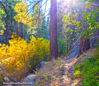
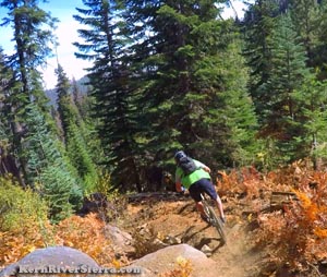
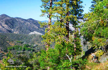
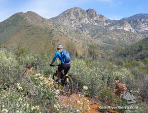
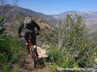
 Upper Tobias Trail.
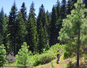
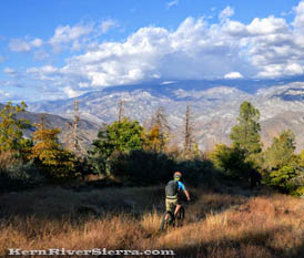
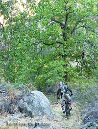
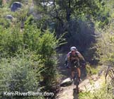