A steep climb up to an accessible peak and great secondary viewpoint.
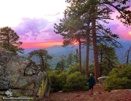
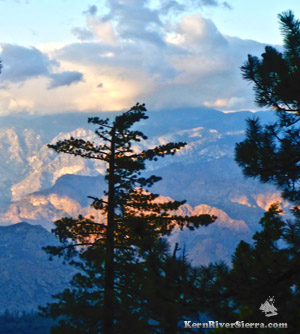
Hiking down from Black Mountain while enjoying the blazing sunset over Sunday Peak. |
THE STATS
- Miles: 2.5 miles total
- Top Elevation: 7438 ft
- Trailhead Elevation: 6263 ft
- Effort: 1400+ feet of gain
- Tread: Up & back use-trail with some off-trail
- Options: Additional Mileage options (see below)
- Land: Sequoia National Forest
- Where: Alta Sierra
- Access: Portuguese Mdw Rd
- Trailhead: Black Mtn Saddle
- Map: Kern River Sierra Outdoor Rec Map
- Black Mountain is on the Sierra Club's 'Hundred Peaks Section' Peak List.
|
Hiking Black Mountain
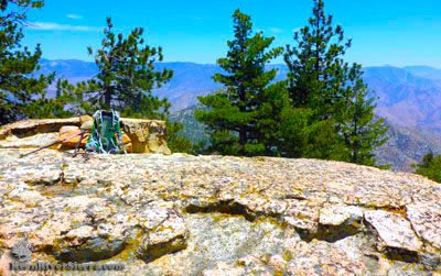 |
| A nice granite viewing platform at the Peak. |
This hike has plenty to offer, despite the short mileage! Providing a great workout with far-reaching views, it's also one of the closest higher elevation hikes out of the Kern River Valley.
When Kernville is 100 degrees, Black Mountain can be in the pleasant 70's.
Challenging at times, the trail steeply weaves through a forested mountainside speckled with large granite boulders.
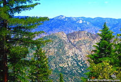
Once on top, the views stretch across Lake Isabella to the Eastern Sierra Crest near Walker Pass, along the entire Kern Plateau to the farthest reaches of the Kern River watershed in the High Sierra, and the Great Western Divide, The Greenhorn Mountains, and Piute range.
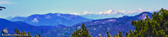 |
Looking north during the hike. From left to right: Flank of Tobias Peak, Maggie Mountain in the distance, Slate Mountain, the mountains of Sequoia National Park, Baker Peak. |
Make sure to hike beyond Black Mountain's peak to another point that reveals even more of the Kern River Sierra!
On the Trail
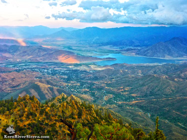 |
| View of Lake Isabella from the viewpoint below the peak. |
The "trailhead" has to be one of the most unglamorous around. At first, there is no indication that a trail even exists.
Commencing at Black Mountain Saddle, the hike starts opposite dirt roads 32e60 and 32e59 near a large USFS burn pile. Start hiking to the right of the flat burning area to a tractor-made berm at the bottom of the grassy hillside.
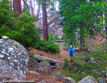
The trail starts to develop as it ascends the slope. At first it is steep and straight, and slightly veers left on an old firebreak.
In less than .2 miles, the trail mellows out and sights of Baker Peak, Sunday Mountain, and the High Sierra peak through the open forest of pine, fir, and cedar.
Keep aiming for Black Mountain; now in sight ahead.
 |
Kern Canyon Walls. |
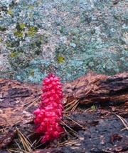 |
Trail decoration. |
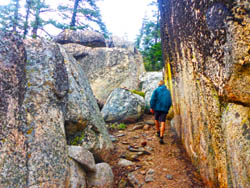
In about a half mile, the path narrows into more of a use-trail as it winds through some interesting boulders on the forested hillside.
In a few places, the trail is very very steep and scrambling over some small boulders is necessary.
Small cairns, (stacked rock markers), are seen all along the hike.
After passing through some really cool rock formations, the trail reaches a false summit and then dips through a swale. Soon, however, the route rises to the peak, where an inviting flat rock slab awaits with a register.
Great views abound in all directions; clamber around the top for better views of the Western Divide, the Kaweah Peaks, Slate Mountain, the tips of The Needles, and more.
For most the hike hasn't reached its destination. Continue in the same direction for another .2 miles, down to next knoll. Hovering above Split Mountain, the eastern views on this point are amazing!
 |
 |
| Enroute to Black Mountain. |
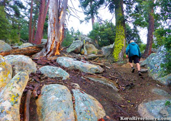
One of the steeper sections of trail. |
Alternate starting point at Greenhorn Summit
 |
| Trail winding through granite. |
To avoid driving any dirt roads and to add more hiking mileage, one can start the hike at the Greenhorn Summit sand shed.
Look for the trail (more of an old road at first) signed 32e61 in front of the sand shed (on the south side). Hike up this trail for about .6 miles, and then go right on the dirt road. In .1 miles, veer left on the dirt road (32e60) for .7 miles, which leads to Black Mountain Saddle and the start of the hike described above.
Round trip, this route adds 2.8 miles and over 800 feet of elevation gain to the hike.
Nearby Trails & Hikes
Directions
 |
| Looking at Split Mountain with Cannell Point and Neanderthal Wall above. |
Drive to Greenhorn Summit, 8 miles west of Wofford Heights.
Turn right on Portuguese Pass Road 24S15 and drive 1.2 miles on the dirt.
Then go right on 25S16 and drive 1.5 miles on a rougher dirt road with large water bars. Turn right at the intersection and park somewhere to the left in the flat area near some cedar trees. This is opposite the dirt roads signed 32e60 and 32e59 near the large burn area.
The hike climbs the hillside behind the burn area.
 |
| Hiking to the second knoll. |
|
