A Must-See hike through Giant Sequoias on the Western Divide Hwy.
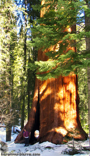
One of many Giant Sequoias just off the trail! |
 |
| Where the big trees are. |
THE STATS
- Hike: Easy 1.3+ mile loop
- Trail: Paved wheelchair-accessible path with side trails
- Effort: About 50 ft of elevation gain/loss
- Elevation Range: 6200 ft
- Sequoia National Monument
- Access: Western Divide Hwy (107) between Kernville & Camp Nelson & California Hot Springs area. Near Johnsondale/Parker Pass.
- Season: Late Spring/Summer/Fall
- Facilities: Paved Parking ($5), Restrooms, Store, Campground
- Map: Kern River Sierra Outdoor Rec Map
|
Exploring the Giant Sequoias
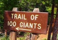
The Trail of 100 Giants is one of the premier attractions of the Sequoia National Monument.
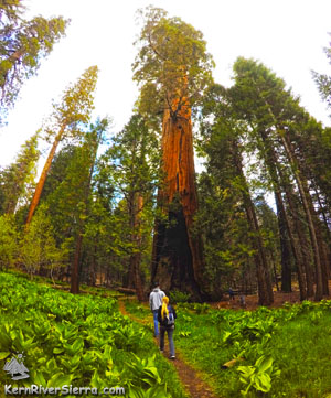
The easy path meanders through the Long Meadow Grove, which is made up of over 700 Giant Sequoias. 125 are greater than 10 feet in diameter, and the largest are 1500 year old! The largest tree is 220 feet high with a diameter of 20 feet.
 |
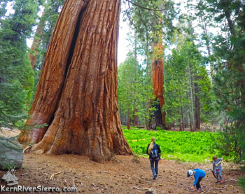
| A lush meadow in the midst of Giants. |
In 2000, President Bill Clinton announced the formation of the Giant Sequoia National Monument at one of these massive trees.
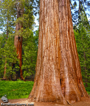
Giant Sequoias (Sequoiadendron giganteum) are native to western slope of the Sierra Nevada in California, which provides a very unique climate necessary for them to thrive. They only grow between the elevations of 5,000 - 7,500 feet in an area of the Sierras that is only 260 x 15 miles wide. The Giant Sequoia is the largest living species in the world!
The Hike
The easy paved path loops around for about 1.3 miles, and allows for a few different loop options. Some other side trails are used as well.
The curious will enjoy the interpretive signs that are scattered throughout the hike.
 |
 |
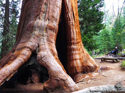
| 1500 year old tree. Wheelchair accessibility on the paved path behind. |
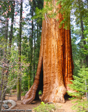
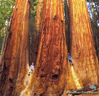
A Sequoia family, viewable just off the upper part of the trail. |
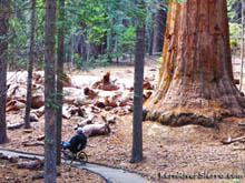
The green of the lush forest and small meadows just add to the colorful Sequoias. While the towering monarchs are amazing, some of the downed Giant Sequoias are equally awe-inspiring. People love to hike on top and inside some of these massive trees.
 |
| Amazing color contrasts in the grove. |
Since the gentle grade is suitable for all ages, families love to visit this grove. This is a very convenient and popular destination, so expect to see other people.
The Details
The main parking area is across the road from the Trail of 100 Giants and features restrooms and a picnic area. $5.00 per vehicle fee is charged to help with maintenance and upkeep.
An additional trailhead is just down the road; across from a campground with yurts, information booth, and a small store.
The Western Divide Hwy (and Trail of 100 Giants) closes in the winter due to snow. It usually opens in May and closes after the first big snowstorm.
Several other Giant Sequoia groves are found in the region and are featured on the Kern River Sierra map. Many have trails, but none are as accessible as the Trail of 100 Giants.
 |
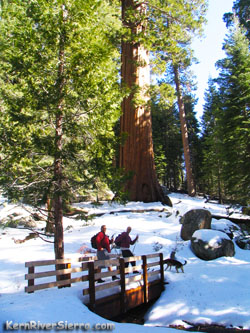
XC Skiing to the grove.
|
| In the winter! |
|
Nearby Activities
 |
| The paved path. |
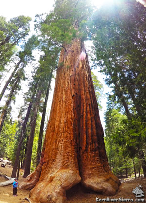 |
| Feeling small. |
Directions
The trail is located on Western Divide Highway (107) in the Seuqoia National Monument. The trailheads are across the road from Redwood Meadow Campground and the official parking area.
From Kernville: The trail is located 45 miles northwest of Kernville (9.5 miles past Johnsondale). Drive north up Mtn 99 north to Johnsondale. Continue 7 miles (now called Mtn 50) to the Western Divide Hwy (107) and turn right (north) for 2.5 miles.
From California Hot Springs: 15 miles northeast of California Hot Springs. Take M56 past the Hot Springs Ranger Station and continue one mile past Parker Pass. Turn left on Western Divide Hwy (107) and continue for 2.5 miles.
From Springville/Camp Nelson: 41 miles southeast of Springville. Take Hwy 190 east through Springville. From Quaking Aspen, drive about 13 miles.
|