Take an adventurous & remote route up to Dome Rock, while enjoying plenty of standout scenery along the way.
|
THE STATS
- Miles: 11.8 miles round-trip
- Top Elevation: 7221 ft
- Low Elevation: 5360 ft
- Difficulty: 2100 cumulative vertical ft
- Tread: Narrow logging roads (now closed to motorized use), sometimes sandy and steep.
- Land: Sequoia National Monument
- Where: Lloyd Mdw Rd/Western Divide Hwy
- Towns: Ponderosa, Johnsondale
- Season: All Year, unless snow
- Optional: World Class Rock Climbing
- Note: This is more of an exploratory adventure-type ride and very remote. Conditions change rapidly. There are no signs.
- Dome Rock Details: Standard Dome Rock Hike
- Map: Kern River Sierra Outdoor Rec Map, 6th ed.
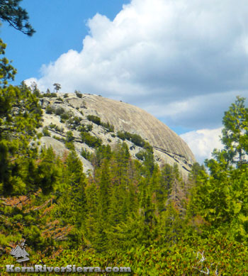
Photo: The route wraps around the south side of Dome Rock before ascending to the top.
|
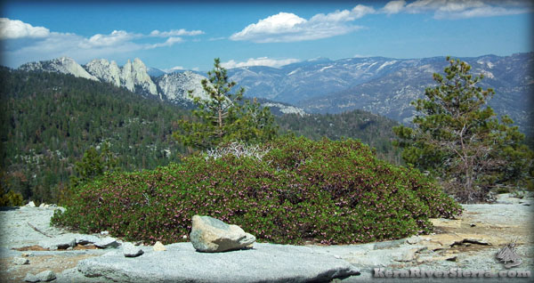 |
The panoramic mountain vista of Dome Rock.
Views looking north with The Needles and Kern Peak. |
The Route to Dome Rock from Lloyd Meadow Road/22S82
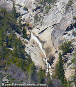 |
| Enjoy views of Upper Peppermint Falls along the way. |
The Normal Dome Rock hike is described here! The unofficial route described here is the long, obscure, uncommon, remote, unpredictable, and adventurous way to arrive at the Dome Rock!
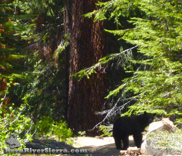
Following old logging roads, this ride (or hike) commences 1/2 mile from Peppermint Creek, near the campground and Peppermint Creek Falls Hike. It features one of the best views of the hidden Upper Peppermint Creek Falls, and sights of The Needles and surrounding mountains along the way. There is often wildlife, ranging from birds to bears to bucks.
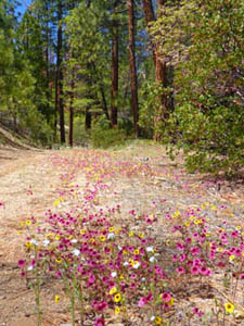
In the spring, the wild flowers can be absolutely stunning in some years. When most of the high country roads are closed, one can still access the Western Divide Hwy area via this trail/road/route. The lower "trailhead" is located over 5 miles from the winter gate on Lloyd Meadow Road, so it requires some extra pedalling if the gate is locked.
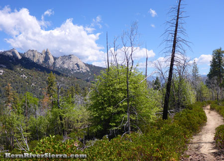 |
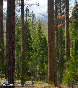
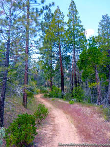
| The lower road/trail weaves through an open sparse forest with evidence of a past burn; making it easy to see The Needles and the other sights along the way. |
On the way up
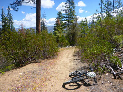
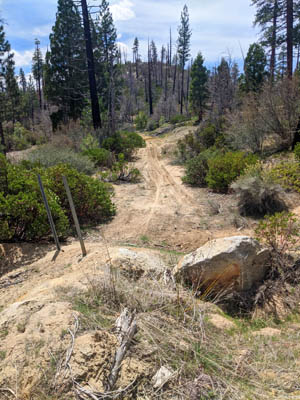
Off Lloyd Meadow Road, the logging road has a large dirt mound blocking vehicle access, allowing this closed road to feel more like a trail. There are usually no signs marking the closed road. (see photo below).
One way, this route is almost 6 miles long. While there is a maze of bushy and overgrown logging roads in the area, there is currently one primary route that is still used by hikers and mountain bikers. It has been relatively maintained over the years. (The old roads can be found on the 6th Edition Kern River Sierra Map.)
The lower section of this route was called 21S63/Sand Hill Road. It climbs at a mellow incline and is enjoyable as it passes by Peppermint Meadows and features nice views of Upper Peppermint Falls and The Needles off to the right. The ever growing views behind showcase Durrwood Canyon (look closely and see 1000's of feet of waterfalls!) and the Sherman Peak Massif on the expansive Kern Plateau.
 |
 |
| On the way up. |
A bear foraging on 21S70 near Dome Creek. |
Spot the destination, Dome Rock, off to the right. It will disappear for much of the ride, but after some tough climbing up to a forested area, it suddenly and dramatically appears as if hanging in the trees- right in front of you!
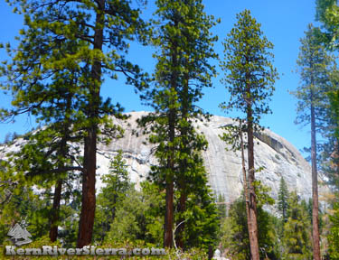 |
| Dome Rock; as seen from the route. |
After a while, the quality of biking decreases with a couple steep and sandier sections. Unless it has just rained a lot, there will be at least a couple short hike-a-bikes. Before long, the sunny and sandy route morphs into a shady trail filled with pine needles. If there are any brushy intersections noticeable, its best to stay right.
The route eventually wraps around the south side of Dome Rock and slightly descends to Dome Creek. Soon after, turn right onto the dirt road 21S70 (there may or may not be a sign). This steadily climbs and crosses Dome Creek again before turning east and meeting up with the main Dome Rock Road, 21S69.
Turn right and ride up to Dome Rock. Enjoy mega views and cooler weather! More about Dome Rock is here.
Return the same way for a fast downhill with some jumpy waterbars and fun corners along the way! This concludes an 11.8+ mile ride!
 |
 |
 |
| Dome Rock, sneaking above the forest near Peppermint Meadows. |
The flower-lined trail in the early summer. Easy riding here, before the steeper climbing up ahead. |
Riding from the top
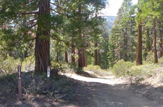 |
| At the intersection of 21S69 (Dome Rock Road) and 21S70. |
 |
| "Trailhead" off Lloyd Mdw Rd. |
To take this route, backtrack on the main Dome Rock Road, 21S69, to road 21S70. This road crosses Dome Creek and eventually narrows with brush, where an old road switchbacks down to the left. This route continues all the way down to 22S82.
Directions
LOWER ACCESS: From the Kern River Valley, drive up M99/Sierra Way north along the Kern River. Cross the Kern River and continue up past Johnsondale.
From Parker Pass Drive/M50, drive towards Johnsondale.
Just northwest of Johnsondale, turn north on Lloyd Meadows Rd (22S82) and drive about 10.5 miles. As the road is descending to Peppermint Creek, look on the left for the old road. Park on the side of the road or down near Peppermint Campground at 10.9 miles.
TOP ACCESS: From Ponderosa on the Western Divide Hwy/107, drive south almost 2 miles. Turn left on road 21S69 and drive .6 miles to the parking area at the end. See Dome Rock Hike for more info.
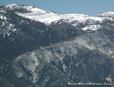 |
| Dome Rock views in the Spring. Looking across to a snowy Sherman Peak (left) and Bass Peak (right) with spring waterfalls on a massive granite feature. |
Nearby Trails & Activities
|

