The King of all-mountain rides in the Sierra & a 2014 IMBA Epic.
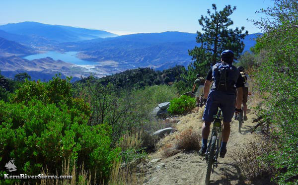
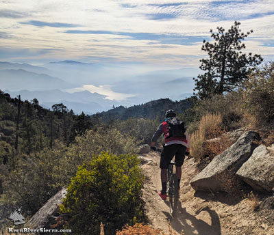
Airplane views of Lake Isabella, near the top of The Plunge. |

THE STATS:
|
UPDATE! April 27, 2021: Upper access is still closed due to the Winter Closure. It just snowed a few inches on the plateau.
The lower section below Powers Peak saddle, has been thoroughly brush with plenty of dirt work! |
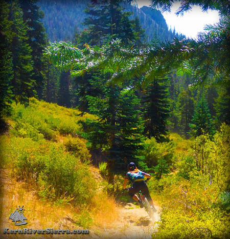
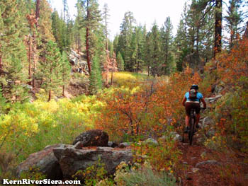
Shredding above 9,000 feet in the Fall. |
|
Current Webcam Views
From Sherman Peak looking south at the upper Cannell Trail area near Sirretta Peak. In the spring/late Fall, these northfacing slopes can still have snow.
Baker Point Webcam looking south and east to Kernville and lower Cannell Trail area. Cannell Point is on the left.
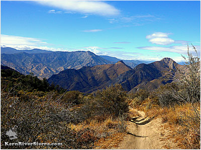
The Cannell Trail
"The flow and speed on cannell plunge is unreal... I'm blown away every time I ride this trail..." Eric Carter, Pro BMX, Mountain X, Downhill Legend
The Cannell Trail (a.k.a. Cannell Meadow Trail) is a big alpine cross-country ride that ends with a bonus 5,000 foot downhill called "The Plunge."
Most people don't even believe it when they hear that Kernville has a ride with less than 2,000 feet of climbing, but 8,000 feet of total drop - right here in California! Epic.
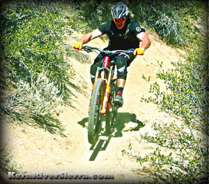
Pro World Cup DH ripper Bruce Klein on the Cannell Plunge section. |
|
On the trail...
As you pedal to almost 10,000 feet and eventually drop to 2,600 feet, you'll pass through an amazing variety of ecological zones and an assortment of trail scenery and conditions. The weather and air temperature can also be as diverse as the ride.
Prepare for some steeper high-altitude climbs, a lot of pedalling, and very long rugged downhill sections - sometimes smooth and flowy, sometimes quite rocky and technical.
This ride is remote and often takes riders much longer than they expect. We've seen it turn into an all-day epic for some, and less than 3 hours for hyper mega-lung people with power gel flowing through their veins.
|
|
 Above: Lower Cannell Plunge flowy-ness. Aiming towards Yellowjacket Peak and Baker Point in the distance. Above: Lower Cannell Plunge flowy-ness. Aiming towards Yellowjacket Peak and Baker Point in the distance.
Left: "We should have brought our climbing shoes!" The ultra scenic Upper Cannell Creek area between Cannell Meadow and Pine Flat. |
It's almost all singletrack, although you cross a few dirt roads as it traverses along the Kern Plateau. One of the hardest climbs is in the first few miles of the ride, but it gives way to an rippin' descent (see the second photo above).
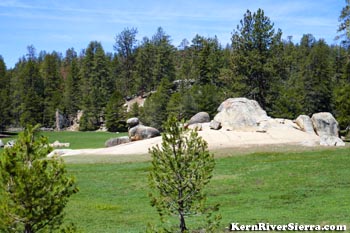
Cannell Meadow in the early summer.
|
At Big Meadow, most riders depart from the Cannell Trail for an easier climb up the dirt road to the obvious saddle.
For those out of water, there is a spring along the side of the road just above Big Meadow (supposedly no one gets sick).
Keep in mind that half the ride is yet to come: after more climbing, a fast rocky downhill leads riders to on of the most picturesque meadows in the Southern Sierra; Cannell Meadow.
Then, an amazing section of riding follows upper Cannell Creek through a canyon to Pine Flat.
And then there's The Plunge....
Get ready for a VERY long descent. Watch out for one hike-a-bike interupts this mega drop from the mountainous forest to the Kern River valley. Most people dont stop here, but just keep going straight to the Kern River Brewing Company.
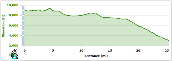
Elevation Profile
Ride Variations
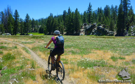
Olympic Medalist Kayaker & Whitewater SUP master, Rebecca Giddens, riding through Cannell Meadow on her way back home. What a way to crosstrain!
|
Its possible to substitute the descent into Big Meadow with a ride down Deadwood Trail to either Cherry Hill Road or farther down into Horse Meadow to ride the Salmon Creek Trails back to Big Meadow. This option adds mileage and additional climbing and descent.
Another option is to ride up to Sherman Peak and back before riding the Cannell Trail. Known as the "bonus," the Sherman Peak Trail ascends near the parking at Sherman Pass.
If you are a road biker or elite cross country racer, the climb up to Sherman Pass Road consistently is voted a top 10 climb in California.
Middle Cannell Plunge. |
|
Dropping in. Near the top of the Plunge below Pine Flat. Lake Isabella sits 5,000 feet below. |
|
Its is truly amazing and suprising to see how many riders are starting to loop this ride. One local has fully looped both Tobias Trail and Cannell Trail from Kernville, an unimaginable feat in one day.
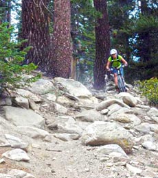
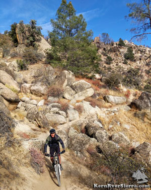
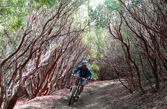
One of the many rowdy sections of trail. |
|
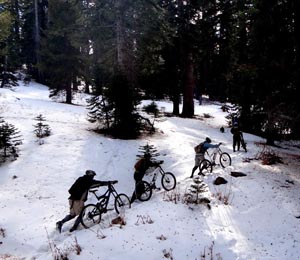
This is what happens if you go too early in the season. At 9500 ft. |
|
About the Pronunciation of "Cannell"
Everyone seems to say something different and asks about the correct pronunciation. Many people who have ridden here throughout the years say "cuh-nell," while most of locals say "Can-uhl."
The USFS District Ranger and USFS Trail manager, who has lived here his entire life, also say "Can-uhl." Either way, it's similar and everyone knows what trail you're talking about!
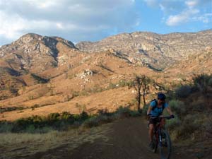
Fall riding is awesome! Upper Cannell Ck. |
Nearby Activities on the Kern Plateau
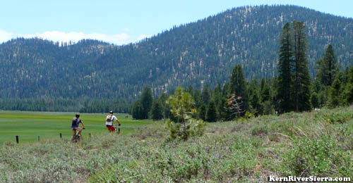
After the first big descent, riders cruise along Big Meadow with Cannell Peak behind. |
Trailheads
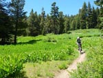
Lushy green in the early summer. |
The lower trailhead is located a couple miles north of Kernville on Mtn 99.
The start of the ride is an hour + further up the road (up Mtn 99, then turn right before the Johnsondale Bridge) at Sherman Pass Rd, northeast of Kernville. While at Sherman Pass, don't miss the view across the Sierra to Mt Whitney, the tallest mountain in the contiguous USA.
Be prepared: this ride can take much longer than expected. Many many folks have come out in the dark. |
Nearby Activities
- Go BikePacking on all the other trails!
- Bike Sherman Peak, Sherman Pass Trail, Cedar Canyon, Kernville area Trails, Just Outstanding
- Rock Climb Spirit Rock, Ghost Rock, Trout Creek Rocks up high; or New Directions, Chico Flat, The Slabs near Kernville; or The Needles & Dome Rock.
- Hike Durrwood Creek, Lookout & Shcaeffer Mountains, Granite Knob, Smith Mountain, Sherman Peak, Valhalla
- Manter Meadow & Taylor Dome & Church Dome & Rockhouse Peak
- Raft, Kayak, or SUP the Kern River
- Kiteboard or Windsurf Lake Isabella
- Canyoneer The 7 Teacups
- Dirt Bike 100's of miles of singetrack trail on the Kern Plateau
- Backpack Domelands or Golden Trout Wilderness
|

