Needles-quality rock on a dome close to Johnsondale.
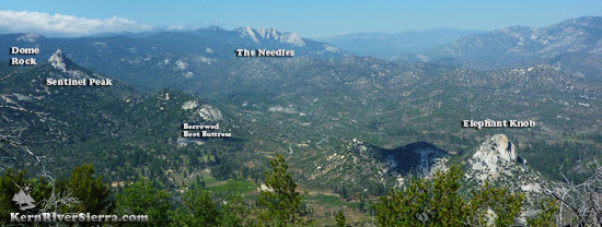
The view of Sentinel and Borrowed Boot Buttress
from nearby Elephant Knob.
|
-
Sport -Trad Climbing
-
5.9 to 5.11
- 1-2 Pitches
- Johnsondale, near Camp Whitsett
|
Climbing
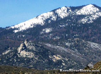
Standing guard over a large swath of the Upper Kern River watershed, Sentinel Peak is one of the more impressive of the large granite rock features in the Johnsondale / Lloyd Meadows Road area.
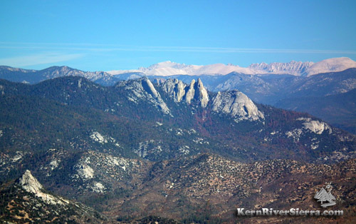 |
| Seeing the Eastern Sierra (including Mt Whitney and Mt Langley) behind The Needles. Sentinel Peak is lower left. |
Located before the usual winter closure gate on Lloyd Meadows Road, the rock can almost be climbed year round.
 |
 |
 |
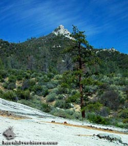
| Plenty of these views on the hike: Sentinel Peak from the ridge below. |
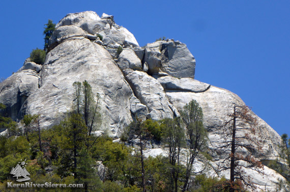
A closer look at the upper southwest side; the trail continues west and eventually climbs the north side. |
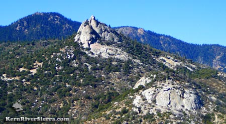
The 20-30 foot+ summit block at the top of Sentinel Peak, as seen from the northwest. The easiest route to the top is considered a short 5.4 climb. |
The northwest corner of the summit block is the shortest route to the top and considered a 5.4 by rock climbers. A bad landing below encourages the use of a rope; there are bolts on top. The south side is rated 5.9, and is the top pitch of Cosmo the Cosmic Crow 5.10+. There are at least 5 named climbing routes on the south and southwest sides.
Many of the routes are described in the older guidebook: Southern Sierra Rock Climbing: The Needles
 |
| Viewing the granite formations from Capitol Rock above Johnsondale. |
Further down the ridge is Borrowed Boot Buttress with a 5.9 face and several 5.7-5.8 cracks, according to Southern Sierra Rock Climbing: The Needles
Nearby Climbing
How to find it
From the Kern River Valley, drive up M99/Sierra Way north along the Kern River.
Cross the Kern River and continue up past Johnsondale on the M99/M50.
 |
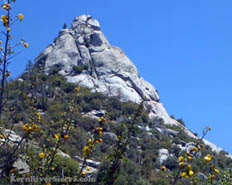
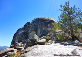
| Sentinel Rock. |
Turn right Lloyd Meadows Rd, 22S82, and drive 2.8 to the unmarked trailhead. (Pass the Camp Whitsett turn off; the trail is .3 miles beyond.)
Park in one of the small turnouts along the road.
The trail is unsigned and can be hard to spot at first.
For detailed information on the trail and hike, click here.
|