Hike beyond the Salmon Creek Bridge to gain views of the waterfalls.
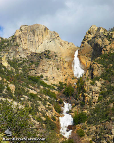
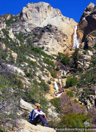
Salmon Creek Middle and Upper Falls.
|
THE STATS
- Miles: 4 mi+ roundtrip.
- Elevation Gain/Loss: 1100+
- Hike: Up & back
- Trail: Motorized Multi-Use
- Elevation: Trailhead 3600 ft; 4500 ft at Bridge
- Land: Sequoia National Forest
- Where: North Fork Kern River
- Access: Kernville
- Map: Kern River Sierra Outdoor Rec Map
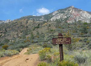 |
| The southern Rincon Trailhead. |
|
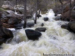
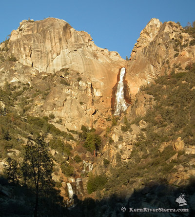
Salmon Creek Falls
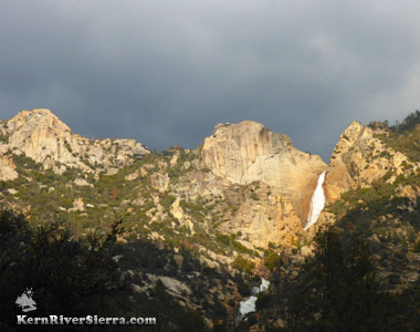 |
The mystifying Salmon Creek. |
This hike showcases one of the great natural features of the Southern Sierra, Salmon Creek Falls!
Above the trail, white ribbons of water pour over the edge of a massive wall of granite and then flow through a series of nonstop slides and waterfalls before merging with the Kern River.
According to Ruby Jenkins "Exploring the Southern Sierra: East Side" Salmon Creek Falls is the highest waterfall in the Southern Sierra. This Yosemitesque creek has inspired adventure and exploration for years. See more on Salmon Creek's canyoneering, rock climbing and EcoChallenge history and the Salmon Creek Falls Trail, which leads to teacupped pools above the waterfalls on the Kern Plateau near Horse Meadow. There is a history of rock climbing Salmon Creek Wall and nearby crags.
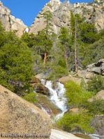
This 450 foot waterfall is sometimes called "Upper Salmon Creek Falls," to distinguish it from the "Lower Salmon Creek Falls" below.
Hiking Rincon Trail
 |
2,000 feet above the Rincon Bridge. |
The Rincon Trail, (33E23), follows the Rincon Fault
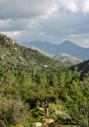 |
On Rincon Trail looking south. |
north for 20 miles, until it ends at the Golden Trout Wilderness boundary near the Forks of the Kern.
The hike described here is on the southern end of the trail, near Ant Canyon on the upper Kern River.
Since Rincon Trail is a multi-use motorcycle trail, you may see an occasional dirt bike passing through.
The trail is hiked year-round, but the initial climb is rather exposed and hot in the summer. After soaking up the wide open views on the 1.6 mile hike up, the oak-shaded terrace near Salmon Creek is always a revitalizing spot to cool off.
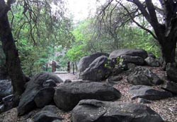
There are several informal campsites near the Salmon Creek Bridge.
The creek at the Rincon Bridge during Spring melt. |
The shaded Rincon Trail bridge
over Salmon Creek. |
To see trailside views of Salmon Creek Falls, hike another 1/4 miles+ beyond the bridge on the Rincon Trail. The views improve as you trek higher!
The "Wild Route" veers off 1/3 mile past the bridge, and the views get progressively more impressive on this route.
The creek flows year round, but the waterfalls are certainly most exciting in the Spring.
Rincon to Packsaddle Trail Hike
 |
Above the bridge. |
Another hiking possibility is to keep trekking up the Rincon Trail and connect with the Packsaddle Trail. Setting up shuttle makes this almost an eight mile semi-loop with about 2,000 feet of ascent.
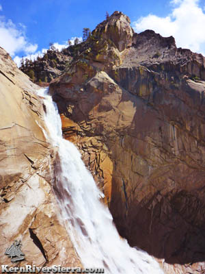
Middle & Upper Salmon Creek Wild Route
For the motivated, undaunted, self sufficient: Hiking up to the middle or upper falls is an amazing adventure. Route-finding skills and good fitness are mandatory, as there is no trail through this very difficult terrain.
A description is here: Wild Route to Upper Salmon Creek Falls
 |
Beyond the Rincon Trail. |
Other Hiking/Exploring Options
Less than a mile up the Rincon Trail, a rough and bushy cairned use-trail veers off to the right. This unobvious trail leads to the difficult scramble up to the south-facing granite walls towering above the trail, known to some rock climbers as "The Rincon."
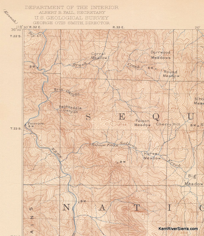
[Trail History Note]: Over a hundred years ago, a piece of this trail continued south at this point to Gold Ledge Creek and through part of The Old Flume Trail.
More impressively, this rugged old trail continued northeast all the way up to the top of Salmon Creek Falls (on the south side of the creek) and connected with the Upper Salmon Creek Falls Trail. Check it out on this 1908 USGS Topo Map.
Nearby Trails
 |
Beauty. |
Trailhead & Directions
Drive 10 miles north of Kernville on Mtn 99 to to Ant Canyon. There is a signed 4x4 road that ascends to the trailhead here. However, its best to drive another .8 miles on Mtn 99, and turn right on the aqueduct road that is signed "salmon." At the first intersection (with the Rincon 4x4 road), make a ridiculously sharp left turn. At the next junction, turn right and follow this road. Look for a road ascending to the left, which leads to a small parking area at the Rincon Trailhead. Most of these roads are signed.
The hike begins with a short climb up an old 4x4 road, and the route soon veers off to the right. Happy Trails. |
