Easily hike to the crest of the Greenhorn Mountains on the Unal Trail
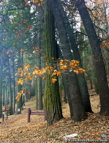
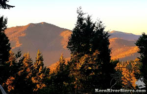
Above: The Unal Trailhead at Greenhorn Summit. Right: Looking out at Sunday Peak and Tobias Lookout.
|
THE STATS
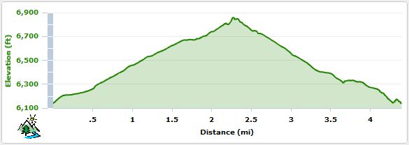
- Miles: 4.5 miles
- Top Elevation: 6861 ft
- Trailhead Elevation: 6100 ft
- Effort: 775 feet of gain
- Tread: Non-motorized multi-use trail
- Type: Loop Hike
- Where: Greenhorn Summit
- When: Spring, Summer, Fall
- Access: Wofford Heights, Alta Sierra
- Land: Sequoia National Forest
- Map: Kern River Sierra Outdoor Rec Map 6th
- Noteworthy: This trail is also very popular with mountain bikers!
 |
Trail Updates
 |
| The top of the Unal Trail in May 2022. The benches survived. |
May 2025: Excellent trail conditions! And scenic park-like greenery currently. The main trail loop and the Windy Gap connector are all brushed and cleared by local mountain bikers.
2022: After partially burning in the devastating 2021 French Fire, Unal trail is open and has been completely cleared of trees and brush by mountain bikers!
While the fire burned in pockets throughout the area, the north side of the loop seemed to fair better overall.
 |
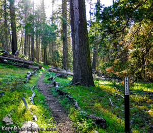
| On the Unal Trail, the north side of the loop. |
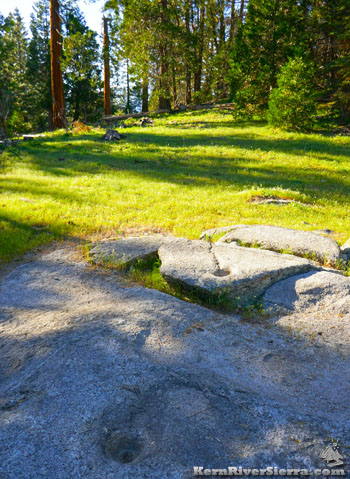 |
Tubatalabal grinding holes, on the left side
of the trail (north side of the loop). |
Hiking Unal Trail
The accessibility and convenience of achieving the crest of the Greenhorn Mountains so quickly, has made the Unal Trail very popular with both hikers and bikers.
The hiker will pass through a forest of Ponderosa, Sugar Pine, Incense Cedar, White fir, and Black Oak with Gooseberry and Bracken fern on the way up to 'Unal Peak'.
If the trailhead sign is holding the USFS pamphlet for Unal Trail, borrow one to use for the hike.
This is an old "interpretive trail," still with some numbered sign posts for self guided tours. The pamphlet describes the sights from the viewpoint of a fictional Tubatulabal (local Native American) child and might appeal to families.
Unal means bear; this is the 'Bear Trail'.
On the Trail
The loop is nice to hike in either direction, although the interpretive trail is numbered for a counter-clockwise loop.
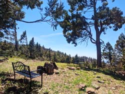
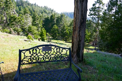
Once reaching Unal Peak, a couple commemorative benches sit in the shade, and a post marks the elevation at the top; 6861 ft. Look through the trees to see the surrounding peaks (Sunday Peak, Baker Point, Tobias Lookout) and the High Sierra's Great Western Divide!
 |
 |
| The bench at the summit. (now there are 2 benches). |
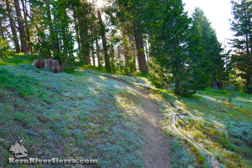
Wonderful greenery on Unal Trail in the Spring. |
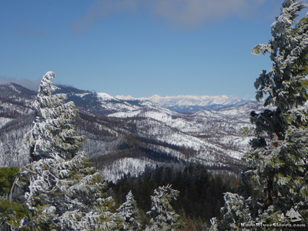 |
| The winter view of the eastern Greenhorns and the Great Western Divide, near the summit of the Unal Trail. |
Elevation Profile
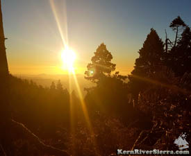 |
| Sunset on Unal trail. |
Nearby Trails & Activities
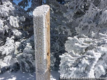 |
| A frosty elevation post in the winter. |
Directions
Greenhorn Summit near Alta Sierra
The trailhead/picnic area is just south of Greenhorn Summit in Alta Sierra, 7+ miles up the 155 from Wofford Heights.
The trailhead is adjacent to the Forest Service work station.
Parking is also available at the "sand shed" at the summit. |
