A historic mining route near Bull Run Creek out of Kernville.
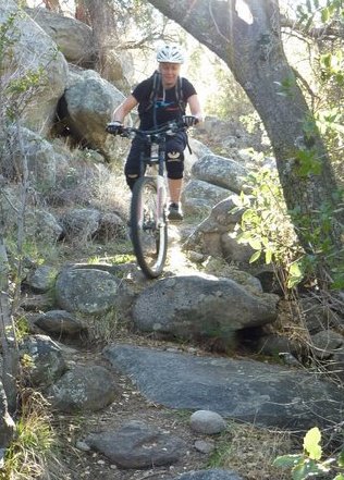
A rough section far above on the old trail on USFS property. |


THE STATS
- Old mining road/trail
- 4+ Miles.
- 200-400 feet of climbing.
- 200-400 feet of drop.
- Out 'n' Back
- NOTE: This route crosses private land. The main route (old road) up to the pools/smelter apparently has a public easement. Respect the private land by not tresspassing and staying on the easement.
- Map: The Kern River Sierra Outdoor Recreation Map, 6th ed shows the private property & USFS boundaries.
|
|
On The Trail
The Bull Run Creek area has a deep history of mining, with some trails and old roads left behind.
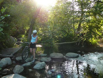 |
| Crossing Bull Run Creek at Whiskey Flat Tr. |
The main trail (an old road with a public easement) ascends from the Whiskey Flat Trailhead to the remains of an old Smelter (where the mineral ore was processed). The remains of rock shelters, from a dense population of miners and workers are scattered all over the area.
Above the smelter area, the land is part of the Sequoia National Forest. (There is also a small section of USFS near the trailhead).
The trail is often rocky, but is a nice gradual slope for riding. Several other offshoot trails are scattered about on both sides of the creek, but most of these are on private land and should be avoided. A hiking description of this area is here.
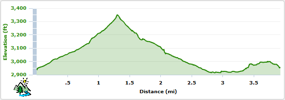
Elevation Profile for a ride to the Smelter
Trailhead
The lower Whiskey Flat Trailhead is the access point. Its located 2 miles north of Kernville at the end of Burlando Road.
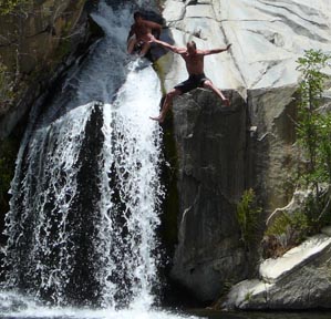 |
| Cooling off in Bull Run Creek on USFS land. |
Nearby Activities
Current Webcam Views
Baker Point Webcam looking south and east to Kernville and surrounding areas. |

