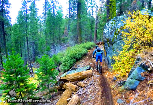
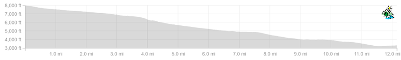
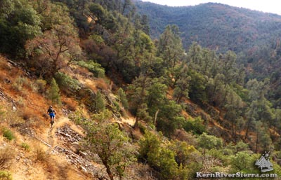
The route has seen continual use since first gold miners came to the Piutes. Even with a full history of human use, the relatively pristine trail shows minimal scars from logging, fire, and mining. Most recently it is utilized and maintained by dirt bikers, who ride various loops on the upper half of trail, and some local hikers who use the lower section. Ride Start From the intersection of Saddle Springs Road and road 22S18, turn right and start riding down 22S18. (See Trailhead Directions below.) Pass an unmarked singletrack on the right, called Middle Trail, and turn right on the next trail, Cold Springs Trail 33E68. This about 1/4 - 1/3 mile depending on where you parked. Cold Springs Trail Shred this super fun trail for about 1.6 miles, where it merges back onto the dirt road for less than 1/4 mile.
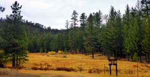
Soon it arrives at Brown Meadow and the signed Clear Creek Trail, 33E45. The official USFS signs warn "Unmaintained" and "Dead End." The trail ends on private property fenced with barbed wire and no trespassing signs.
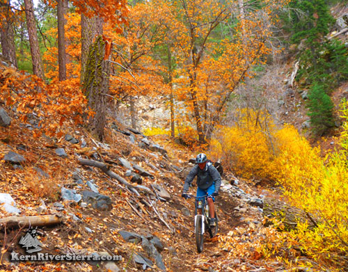
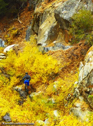
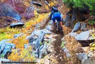
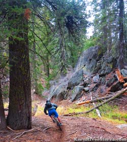
Clear Creek Trail The adventure begins here! Once you start descending, there is no easy way back up. The awesome singletrack continues down the ever deepening canyon. Soon,you may notice another trail popping in on the left; that is Brown Peak Trail which is often looped by motos. Farther down (roughly 2.7 miles into the ride), the unofficial Middle Trail veers off and climbs back up (600+ ft in elevation).
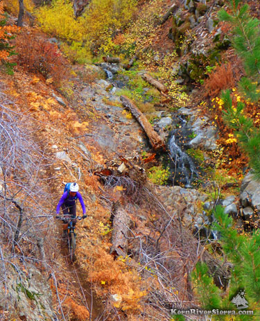
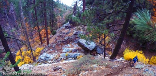
Burton Mill Split After riding about 3.3 miles, there is an important split that's easy to miss. A log is blocking the visibility of the main trail which veers left. The majority of dirt bikers seem to turn right here, near the unmarked site of old Burton Mill. The trail climbs about 500 ft+ to Saddle Springs Rd in less than a mile. This is the best available option to loop the upper section of this ride. Go left to stay on Clear Creek Trail. Below this point, the ride is very committing and there is no easy way out of the canyon. After an abrupt uphill, the trail gradually features steeper and more technical riding. Some of the best scenery is ahead, along with all those creek crossings.
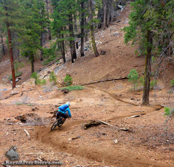
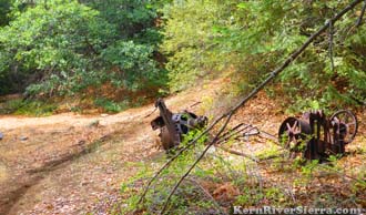
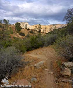
Valley View Split At about 5.3 miles or so, the ride comes up on some old mining artifacts and the steep trail to Valley View, the last connector to Saddle Springs Rd. Clear Creek Trail continues to the left. Above Clear Creek Canyon The trail eventually rises high above the creek; at roughly 6.7 miles. There is a short pleasant climb and traverse on good trail. Don't miss the views of the granite bedrock water slides are down below. Easy riding through oaks and the grassy slope continues, as the fun factor increases for the rest of the ride.
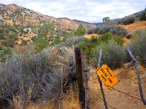
Private Property Gate At about 9.3 miles, the trail comes to the private property fence. There is no indication that the property owners are trying to close access here. There is a Forest Service sign attached that says "Please close gate." From this point on, be respectful of private property and leave no trace. There may be active cattle grazing in the area. The next 2.2 miles of trail is really enjoyable through here! End of the Ride Just before the ride ends at Caliente Bodfish Road, at almost 11.5 miles, the trail turns across a hill before it switchbacks down to the flats. It's a good idea to stop here and scout the fence where the original gate and USFS sign posts are (the trail sign is gone, but posts are still standing.) This is where the original trail comes out, and all bikers should exit here and move along.
The main trail seems to disappear right before the fence, and it's best to not have wandering mountain bikers all over the private property. (See photos below and discussion on Private Property below). At the end of the ride, turn left and bike up the pavement 1/2 mile to the public Havilah Museum and picnic area and celebrate the ride! Private PropertyA previous owner of the land fenced off the access and removed the forest service signs. Barbed wire was installed with plenty of "No Trespassing" signs, and few people used the lower section of trail since. There is a new owner, and there appears to be no new signs or attempts to shut down the trail any further. There seems to be a "Don't ask, Don't tell" policy. Although the private property section of the trail is not shown on the previous editions of the Kern River Sierra topo map, this is a well established historic route with a very strong case for prescriptive easement.
Parts of this trail are marked with triangle tree blazes, the oldest in the Sequoia National Forest. This trail has been utilized during 3 separate centuries. Clear Creek Trail is featured on official maps and published in several guidebooks, such as John Frank's "Southern Sierra Mountain Bike Trails", "Self Propelled in the Southern Sierra" by J.C. Jenkins, "Exploring the Southern Sierra: West Side" by Ruby Jenkins. ThoughtsHere are some guidelines that may help reestablish this as a mountain bike trail, or at least keep conflict from happening. (This does not reflect the opinions of the USFS or the landowner, and has no authority whatsoever.)
Options
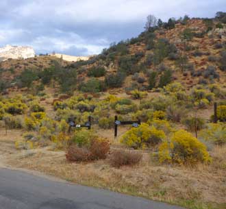
Directions & TrailheadsThe Lower Trailhead:
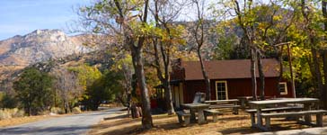
Leave a shuttle car in Havilah at the historic Kern County Courthouse Museum and adjacent picnic area. This is less than 1/2 mile south of the trailhead. Havilah is 20 miles south of Kernville, and 9 miles South of lake Isabella. From Lake Isabella, take Lake Isabella drive south and continue on Caliente Bodfish Road to Havilah. Or if coming from the south, take Borel Rd from Hwy 178, and turn left on Kern Canyon Rd. In Bodfish turn right on Caliente Bodfish Rd, and continue about 7 miles. The Upper Trailhead: From Havilah, drive back north on Caliente Bodfish Road 4+ miles, and turn right on Saddle Springs Road. Continue on this very rough dirt road for almost 15 miles and park either at the high point before Road 28S18 or turn right on 28S18 and park on the side of the road. This takes awhile - at least an hour from Havilah!
|
||||||||||||||||||||||||||||||||||||||||||||||||||||||||