A fast and fun downhill shuttle ride in the Breckenridge Mountains.
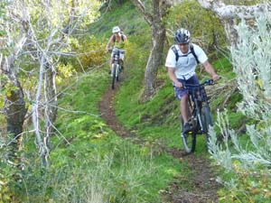
A flowy ribbon of forested singletrack. |

THE STATS
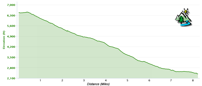
- 8.2 Miles (1 way)
- Effort: 150 feet of climbing
- Thrill: 4250 feet of drop
- Ride: Shuttle Ride, Ebike, or Out 'n' back
- Tread: Motorized Multi-Use Trail
- Top Elevation: 6750ft
- Lower Elevation: 2400 ft
- Land: Sequoia National Forest
- Towns: Haviliah, Breckenridge Mtn, Lake Isabella
- Map: Kern River Sierra Outdoor Recreation Map, 6th ed
|
April 2025 Update! The trail is absolutely popping with vibrant green and wildflowers, and the creek crossings are a little challenging!
May 2025 Update! The lower half of the trail is unaffected by the 2024 Borel fire, while the middle section includes patchy burn areas and will probably get a little bushy as the spring growth kicks in. Some of the ridge areas are rutted. The greenery, miners lettuce, and flowers are quite striking with the blackened trees. Higher on the trail, the burn damage is noticeable. Currently, there are about 4 small trees down, and one large Ponderosa, with ride-arounds on all. Basically the entire trail is mostly clear for riding!
|
The Ride
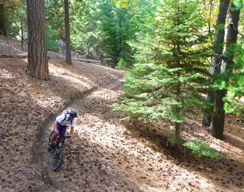
If you are looking for a smooth and fast downhill ride, Mill Creek Trail is an excellent choice.
 |
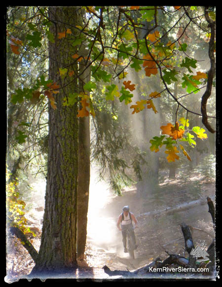
Lovin it! Fall Colors on the Mill Creek Trail.
|
While a variety of riders have always loved this trail, its starting to attract a few downhillers who shuttle laps. Because of the long slow road access, having a designated shuttle driver is key on this one.
For a fantastic day of descent (about 9,000 ft), set up a double shuttle and ride both Mill Creek and Remington Ridge Trails.
The Details
This multi-Use motorized trail is popular with hikers and horsemen, who normally use the lower portion of the trail. Expect to see other users in the lower 3 miles of trail, especially in the Spring when the wildflowers are popping! Motorcycles are not commonly seen but they do use the trail.
Throughout the 4250 foot drop, the terrain changes from a lush pine and fir forest, to grassy ridgelines and into the oak-studded high desert terrain of the lower Kern River.
Snow shuts the trail down in the winter, but it is ridable for most of the Spring, Summer, and into late Fall.
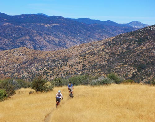 |
| The high-speed grassy ridge section. |
The super-fun, fast and flowy section at the top leads into a section of tight switchbacks and down into the creek drainage. It ends above the Lower Kern River on the Kern Canyon Road.
Dont Miss:
The nearby Remington Ridge Trail makes for a excellent double shuttle.
Elevation Profile
Trailheads
The lower trailhead:
Take Highway 178 southwest from Lake Isabella about 14+ miles to Kern Canyon Road near the Democrat Fire Station. The trailhead is located 1.5 miles up the Kern Canyon Road.
The upper trailhead:
If you dropped a shuttle vehicle, return north on Hwy 178 and take the Bodfish exit #42. Turn Right on Lake Isabella Road, which will turn into Bodfish road. Drive 2.3 miles past the small historic town of Havilah, and go right on Breckenridge Road. Take this for about 9 miles, passing Lightners Flat (where Remington Ridge Trail starts). The signed trailhead is off the dirt road on the right near Squirrel Meadow. Start riding the dirt road up a little hill to the actual trailhead.
 |
 |
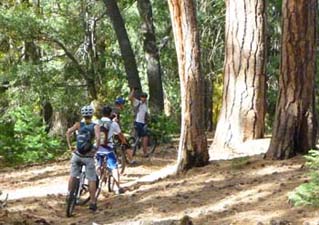
| Group shuttles are the way to go. |
Green in the Spring! |
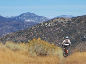 |
Dropping into a vast land.
|
Nearby Activities
|

