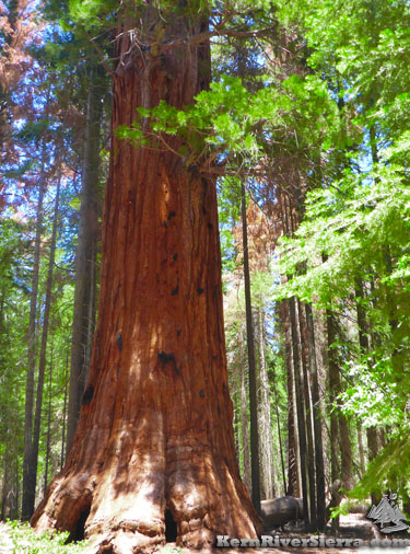
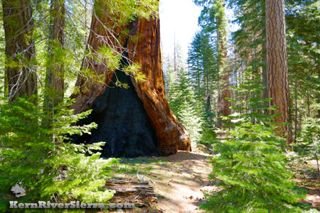
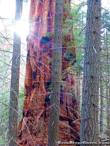
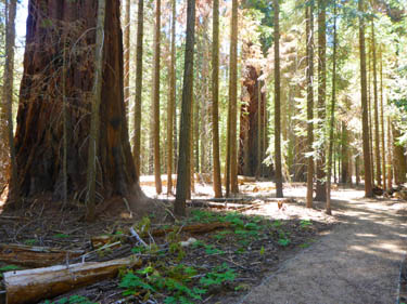
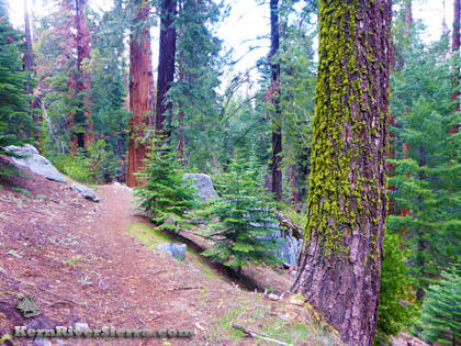
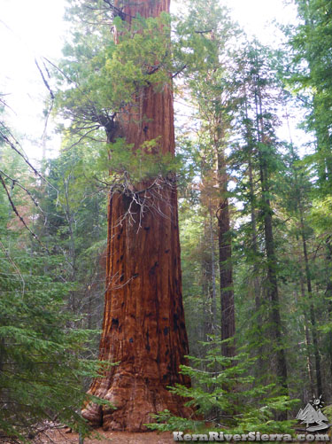
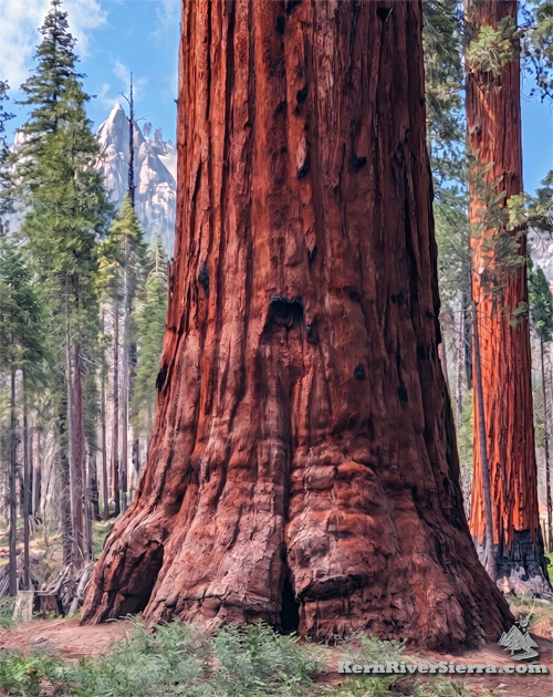
Giant SequoiasThis 1500 acre grove contains 800 trees that are over 10 feet in diameter and a couple that are 20 feet wide. Freeman Grove is also the easternmost grove of sequoias in the US.
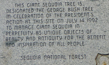
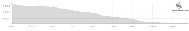
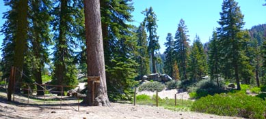
The famous George Bush Tree is a highlight to see; just off the trail with a commemoration plaque. An even bigger tree, the Great Goshawk Tree is hidden on the slopes south of the creek. It is the 29th largest tree in the world; 255 feet high with a diameter of 23 feet. Several other large trees appear just off the trail throughout the hike. On the HikeThe trail descends from near the Western Divide Hwy to Lloyd Meadow area near Golden Trout Wilderness, dropping over 1500 feet in elevation. Many of the Giant Sequoias are in the lower half of the trail. [An alternate hiking option is the short dirt interpretive path (wheel-chair accessible) that loops down to the George Bush Tree. This is a great option for families and it connects to the main trail for longer walks. It's located near Lloyd Mdw Rd. See description below.]
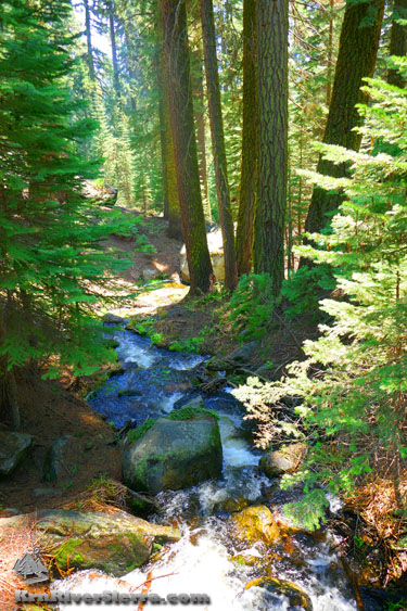
Note that Freeman Creek trail is also used by horse riders, mountain bikers, and some free range cows that have a bad habit of cutting the switchbacks. This is a popular trail on summer weekends, so be aware of other users.
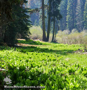
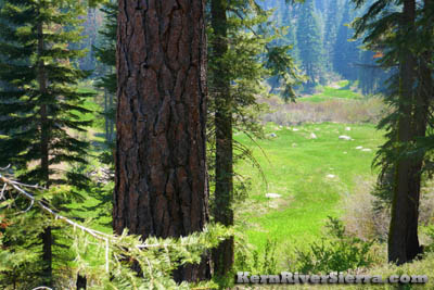
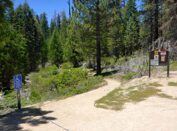
Near the top, the trail is steeper as it descends a ridge with a quick view of Hermit Spire across the way. After a series of switchbacks, the entire lower trail is relatively flat. If only hiking to the Giant Sequoias or George Bush Tree, the hike is significantly easier and shorter from the lower trailhead. Roundtrip the entire trail makes about a 9 mile hike with 1550 feet of climbing. Like most of the trails in the southern sierra, the season and recent conditions have a big effect on the trail conditions. Downed trees, sticks, bark, and needles are often on the trail in the Spring. The summer tourist season often brings some guided horse tours, which can impact the trail. Most of the horse use is on the lower 1 mile of trail, enroute to the George Bush Tree. President George H.W. Bush Tree/Freeman Creek PathA short wheelchair-accessible dirt path creates a separate loop at the official Freeman Creek Trailhead (see directions below). It circles past some giant pines before reaching the sequoias and the huge George Bush Tree. It is probably the easiest hike around, and it connects to the primary trail which features several more Giant Sequoias. This is also open to bikes, and makes a good child friendly loop. The loop is less than 1/2 mile and has about 40 feet of elevation gain. The parking area sits thousands of feet below the impressive Hermit Rock.
Other Hiking OptionsFreeman Creek Trail actually continues east across Lloyd Meadow Road, and connects to some other trails in the scenic Lloyd Meadows and upper Forks of the Kern area. It directly connects to the Fish Creek Trail (which leads to the Jerkey Meadows Trailhead) and the Kern Flat Trail (Forks of the Kern Trailhead). A fun adventurous side hike: Continuing down Freeman Creek, yields some impressive granite teacups and waterfalls after passing the Pyles Boys Camp. Access this area by continuing on the Lloyd Meadows area trails (refer to the Kern River Sierra Map). Freeman Creek Trail can be combined with the Summit Trail and the Camp Nelson Trail as well. Elevation Profile from Western Divide Hwy
Nearby Trails & Activities
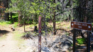
DirectionsThe Upper Trailhead is off North Road, 21S50, which is off the Western Divide Hwy near Quaking Aspen Campground and Ponderosa. People come from every possible direction for this trail, but once near the campground, go north on North Road a short distance. A sign on the right marks the Freeman Creek Trail. One can park here, or continue down the dirt road to the gate and official start of the trail. If hiking from the Quaking Aspen Campground, cross the 190 and take road 21S99 to the trailhead. The Lower Trailhead is off Lloyd Meadows Road, 22S82, which is north of Johnsondale. Drive about 16 miles north on 22S82. Look for the signs displaying Freeman Creek Trail 32E20 just off both sides of the road. (The trail to the left is the one described above). Most mountain bikers park in a dirt pullout just beyond this on the left. The Interpretive Loop Trailhead at the George Bush Tree is accessed near the lower trailhead. Turn left on the dirt road 20S78 and drive up to the George Bush Tree Trailhead. These trailheads are all depicted on the Kern River Sierra Map.
|
|||||||||||||||||||||||||||||||||||||
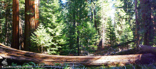
 Giants on the Freeman Creek Trail. Photo taken in 2026.