Have a blessed hike to visit the rock cathedral towers of Church Dome at a trail saddle overlooking a large swath of Domeland Wilderness.
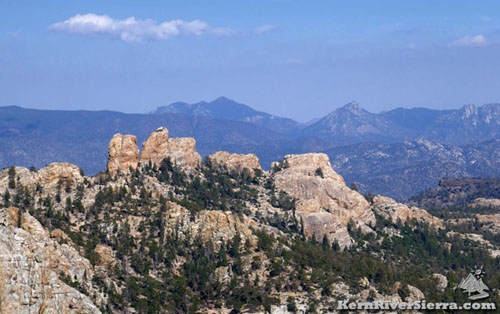 |
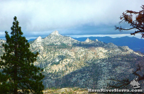
| Church Dome(s) as seen from Taylor Dome. The flat volcanic peak of Black Mountain is to the right. The Eastern Sierra backdrop includes Sawtooth Peak, Lamont Peak, & Lamont Pinnacles (right to left). |
|
THE STATS
- Miles: 2.6 roundtrip
- Top Elevation: 7850 ft
- Trailhead: 7080 ft
- Vertical Effort: 800 ft
- Tread: Wilderness Trail
- Trail: South Woodpecker Tr
- Type: Out & Back
- Options: Rock Climb; longer hikes possible; see below.
- Land: Domeland Wilderness & Sequoia NF
- Where: So. Kern Plateau
- Access: Cherry Hill Rd
- Trailhead: Rd 24S13
- Near: Kernville
- Map: Kern River Sierra Outdoor Rec Map, 6th ed.
|
 |
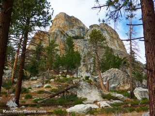
| Church Dome as seen from the Woodpecker Trail. |
The Church Dome Hike
Church Dome / Woodpecker
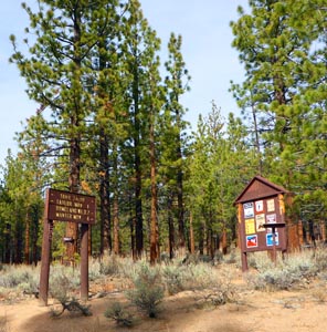
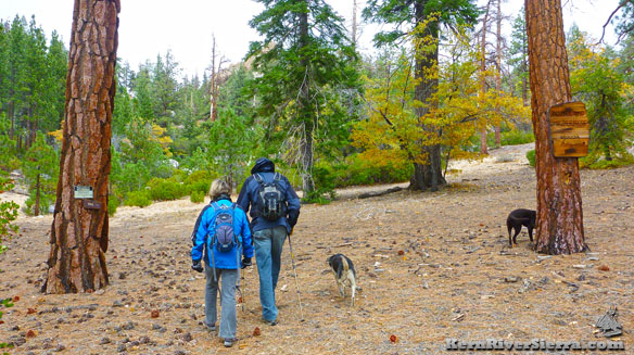
Trailhead near Taylor Meadow.
|
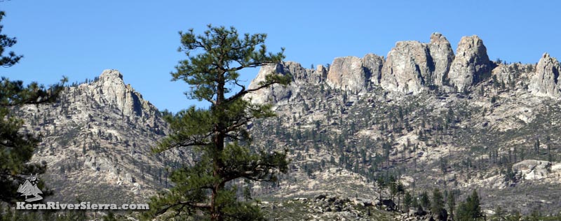
As one of the emblematic features of the southern Kern Plateau, Church Dome contains numerous granite spires, towers, and crags that are situated on an especially rugged ridge overlooking Domeland Wilderness.
Woodpecker Trail (34E08) provides access to the pass between some of these large rock formations.
Hiking just beyond the saddle will progressively open up a wide vista of the huge domes and unique features hidden throughout the Yosemite-like "Domelands."
The highest point of Church Dome is tower known as "Taj Mahal" at 8515 ft in elevation. Reaching the summit requires technical rock climbing skills.
The names of the major formations are described here.
 |
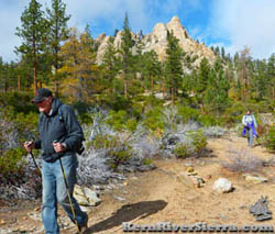
| Crossing into Domeland Wilderness. |
On the Southern Woodpecker Trail (34E08)
The Woodpecker Trail commences in Taylor Meadow at the junction with Big Meadow Trail, 34E15, and continues north through Domeland Wilderness. It passes Manter Meadow and Trout Creek to finally reach Sherman Pass Rd in about 16 miles near Bald Mountain Lookout.
 |
| On the lower-use Woodpecker Trail. |
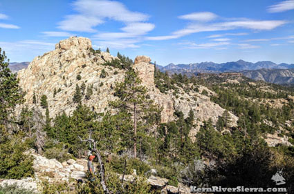
View from the trail near the Domeland
Wilderness Boundary. The southeast sides of the "Convent," "Mosque" & "Ayatolla".
|
This hike starts just off the dirt road, 24S13, and reaches the trail pass between the domes in about 1.3 miles and almost 800 feet in elevation gain.
The first section of the trail parallels a logging road, as it ascends through an open forest of chapparral, oaks, and Jeffrey Pine.
In about 1.2 miles, the trail reaches the Domeland Wilderness boundary and then continues up to the high point. Hiking a little beyond the saddle yeilds far reaching views of domes, crags, and spires to the north.
While peering into the heart of Domeland Wilderness to the north, one will still see evidence of the Manter Fire of 2000.
 |
Left: The awesome Domelands, as seen from near the Church Dome saddle. Above: Happy hikers. |
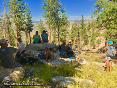 |
| Taking a lunch break at the Church Dome saddle. |
Hiking Options & Excursions
Black Mountain, 7864
Overlooking the Manter Creek drainage and White Dome, Black Mountain is the flat-topped volcanic mountain to the east of Church Dome. It can be reached by hiking off trail from Woodpecker Trail. It's best to depart the trail just beyond the Wilderness sign and head northeast. A topo map really helps find the best route. This hike adds about 3.6 miles and 1,000 feet of elevation gain to the Church Dome hike.
Taylor Dome
The Woodpecker Trail also connects to Big Meadow Trail, 34E15. From the Church Dome trailhead it is about a mile away. Far up the ridge, sits Taylor Dome, a peak on Sierra Club's SPS list. Details on the trail and hike to Taylor Dome are here.
Big Meadow Manter Meadow Trail Loop
A larger 12 mile loop is possible by linking Woodpecker Trail, South Manter Trail, and Big Meadow Trail. Its described on both the pages for the Manter Meadow Hike and the Taylor Dome/Big Meadow Trail.
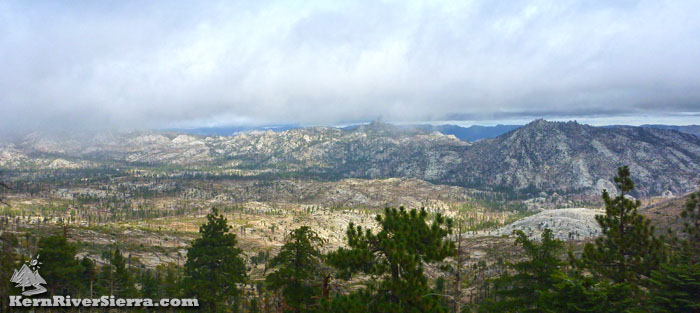 |
| Looking out over Domelands from the Woodpecker Trail pass, as a storm approaches. |
 |
| Looking east of the trail, to the "Temple of Doom". |
Trailhead
From Kernville, drive up Mtn 99 for 19 miles, then turn right before the Johnsondale Bridge onto Sherman Pass Drive. In 6 miles, turn right on Cherry Hill Road (22S12).
Take this for about 18 miles and veer left to stay on 22S12 toward Taylor Meadow. (Don't turn right on 24S12).
In another 3 miles, stay left and take road 24S13. This will wrap around Rattlesnake Meadow and eventually come to the trailhead near the end of the main road.
From Kennedy Meadows, take Sherman Pass Road beyond Sherman Pass Overlook to Cherry Hill Road and (follow directions above.)
From Parker Pass Dr/M50, drive past Johnsondale and cross the Kern River. Sherman Pass Drive is just past the Johnsondale Bridge on the left. Take this to Cherry Hill Road and (follow directions above.)
 |
| Church Dome's 'backside', as seen from the Rockhouse Peak hike in the northeast. |
|
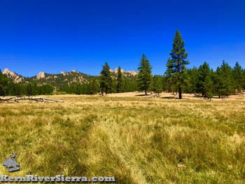 |
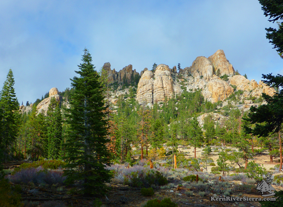
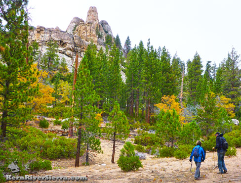
| Taylor Meadow with Church Dome in the background. |
Other Nearby Activities
|
